
National Forest and Land Fire Hotspots Decrease Significantly
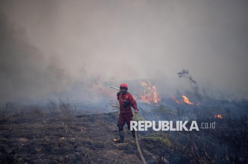
The Ministry of Forestry has announced that the number of high-confidence forest and land fire (karhutla) hotspots nationwide has decreased significantly. As of Monday (28/09/2026), the total number of high-confidence hotspots nationally stood at 365, a decrease of 194 points from the 559 points recorded the previous day.
Based on SiPongi data, the Ministry of Forestry stated that South Sumatra recorded the highest number of high-confidence hotspots. Meanwhile, Central Kalimantan experienced a significant decline.
In South Sumatra, 96 hotspots were recorded last Monday, an increase from 29 points the previous day, while Jambi recorded 25 points, up by 5. Conversely, Central Kalimantan dropped drastically to 37 points from 134, and South Kalimantan decreased to four points from 25.
West Kalimantan recorded no high-confidence hotspots, down from 11 points the previous day. Riau also reported no hotspots, consistent with the previous day’s figures.
Overall, the Ministry of Forestry revealed that the number of high-confidence hotspots in the six priority provinces fell from 204 to 162. Intensified operations are currently directed towards regions showing increases or those still exhibiting high hotspot activity, particularly South Sumatra and Central Kalimantan.
The Ministry of Forestry reiterated that a hotspot does not necessarily represent the number of fire incidents. A hotspot is an indication of surface temperature anomalies detected via NASA Terra/Aqua, SNPP, and NOAA-20 satellites.
The Ministry noted that a single fire incident can be detected as multiple hotspots; therefore, all indications must be verified through ground checks or direct field inspections. They also emphasised the continued strengthening of fire control through integrated land and air operations.
The Ministry recorded that the government currently has 61 aerial units on standby, consisting of 17 units for patrols and Weather Modification Operations (OMC) and 44 units for water bombing. Fifty-five aerial units are supporting efforts in the six priority provinces, while six additional water bombing units are deployed to support other affected areas.
According to BMKG Aviation monitoring at several major airports in priority provinces on the night of 28 September, visibility varied. Visibility at Supadio Pontianak was recorded at approximately two kilometres under smoky conditions, while Pekanbaru was around eight kilometres, Jambi seven kilometres, Palembang 10 kilometres or more, and Banjarmasin approximately nine kilometres.
The Ministry stated that visibility conditions can change within a relatively short period depending on weather conditions and airborne particle concentrations. Consequently, continuous monitoring will be conducted to support fire control operations while ensuring the safety of public activities and aviation.
The Ministry of Forestry advised the public, particularly those in areas experiencing declining air quality, to reduce outdoor activities if air conditions worsen and to wear masks when necessary. Special attention should be given to children, pregnant women, the elderly, and individuals with respiratory issues or chronic illnesses.