
NASA Satellite Data Reveals Far Greater Scale of Venezuela Earthquake Damage
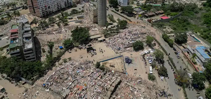
The United States space agency NASA estimates that almost 59,000 buildings were damaged or destroyed by the powerful earthquake that struck Venezuela on 24 June. The estimate is far higher than official data released by the Venezuelan government. Based on a report compiled using satellite radar data analysis, researchers estimated approximately 58,870 buildings were affected across the regions hit by the quake. “Approximately 58,870 buildings were likely damaged or destroyed across the affected area,” stated the report, which was compiled based on satellite radar data on 25 June by researchers Corey Scher and Jamon Van Den Hoek from Oregon State University. The report utilised radar data from the European Space Agency’s Sentinel-1 satellite. The researchers explained that the analysis results represent a rapid initial assessment based on changes to the earth’s surface detected from space. They described the results as a quick preliminary assessment showing sudden surface changes consistent with damage, and cautioned that the findings have not yet been verified through direct on-the-ground inspection and should still be treated as an early indicator. Meanwhile, the Venezuelan government reported a much lower number of damages. In the latest official report delivered by National Assembly President Jorge Rodriguez on Monday, a total of 855 buildings were recorded as damaged, including 189 that collapsed. Rodriguez also stated that the death toll from the twin earthquakes continues to rise. According to the latest report, at least 1,719 people have died, while 5,034 others have been injured. The United States Geological Survey recorded two major earthquakes striking Venezuela on 24 June, separated by an interval of only about 39 seconds. The first quake, with a magnitude of 7.2, occurred approximately 23.9 kilometres northeast of San Felipe in Yaracuy state. Shortly afterwards, a magnitude 7.5 earthquake struck an area about 23 kilometres southeast of Yumare, also in Yaracuy state. The significant difference between satellite-based estimates and official government data indicates that the disaster impact assessment process is still ongoing, as field verification is carried out to obtain a more accurate picture of the damage.