
NASA Map Remains Red as Carbon Monoxide Spreads Across Indonesia’s Skies
Jakarta — Air pollution cannot always be judged by the appearance of the sky. Pollutant gases can remain in the atmosphere and move with the wind, spreading far from their sources. Satellite monitoring is one way to understand how these gases move through the atmosphere.
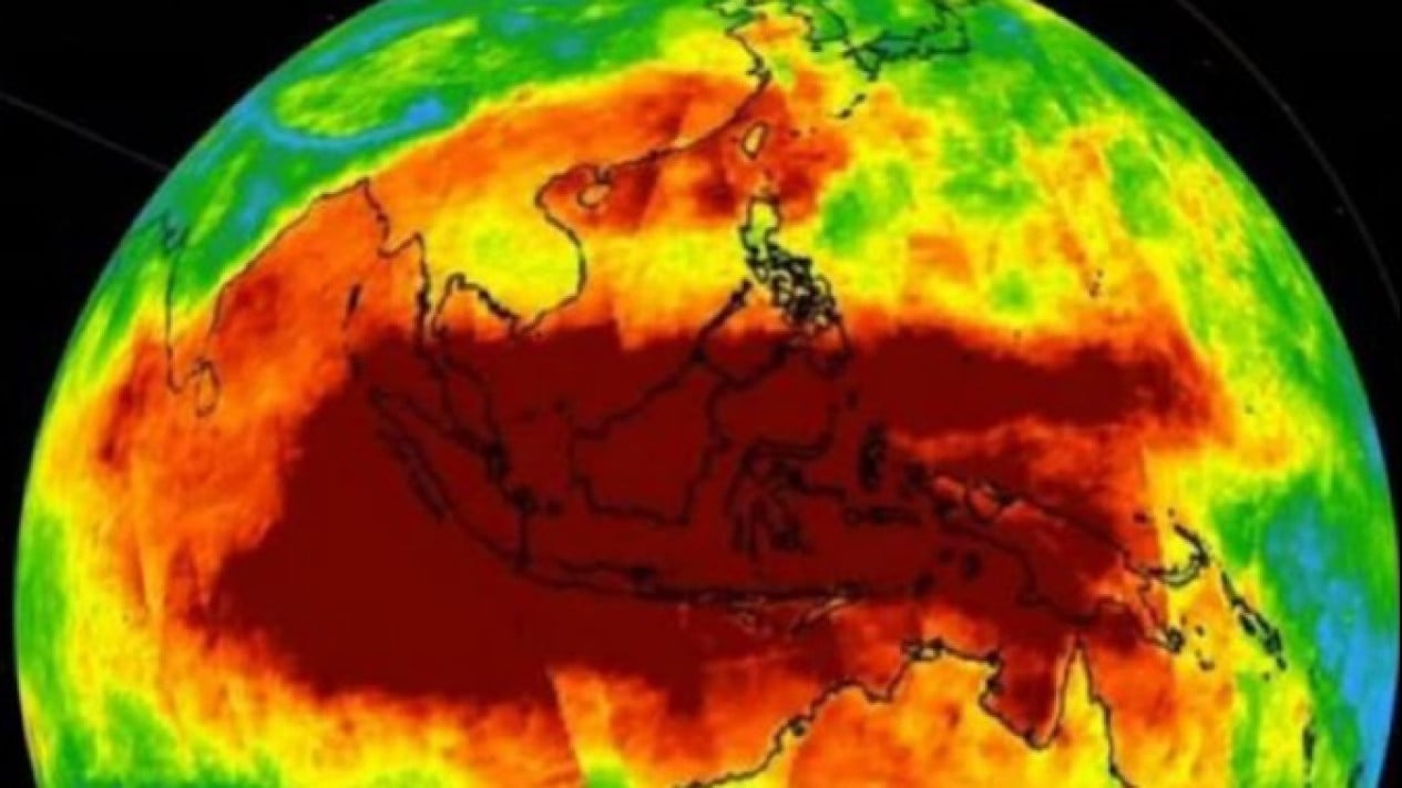
This was illustrated by NASA Eyes on the Earth visualisation for 16–18 October 2026. The map showed carbon monoxide (CO) across several parts of Indonesia, including Sumatra, Java, Kalimantan, Sulawesi and Papua, as well as neighbouring countries.
The red colouring dominating the map drew attention, but what does it mean, and how does it relate to air conditions in Indonesia?
1. NASA map shows atmospheric carbon monoxide concentrations
NASA’s visualisation displays “daily CO at 500 mb (ppbv)”, meaning the concentration of carbon monoxide in an atmospheric layer with a pressure of about 500 millibars, or roughly 5,500 metres above sea level.
The data come from the Atmospheric Infrared Sounder (AIRS) instrument aboard NASA’s Aqua satellite. The map’s colour scale ranges from 0 to 160 parts per billion by volume (ppbv). Red indicates relatively higher CO concentrations than blue or green.
However, red does not automatically mean that the air at ground level in the area is dangerous to breathe. The measurement represents conditions at a particular altitude, not the level of exposure experienced directly by the public.
2. Carbon monoxide can travel far from its source
Carbon monoxide is a colourless, odourless gas produced by incomplete combustion. Sources include forest and land fires, motor vehicles, industrial activity and the burning of other fuels.
NASA says carbon monoxide can remain in the atmosphere for about a month. During that time, it can be carried by the wind across islands and even national borders.
3. BMKG records 478 hotspots on 16 October 2026
The distribution of carbon monoxide can be compared with fire and smoke monitoring conducted by the Meteorology, Climatology and Geophysics Agency (BMKG). The agency recorded 478 hotspots on 16 October 2026.
Source: jawawa.id (https://jawawa.id/newsitem/nasa-map-remains-red-as-carbon-monoxide-spreads-across-indonesias-skies-1792381835)
Originally published by VIVA.co.id (https://www.viva.co.id/berita/nasional/1936903-peta-nasa-masih-merah-karbon-monoksida-terdeteksi-membentang-di-langit-indonesia), translated from Indonesian