
Mud Lake Threatens to Overflow, Nepal and China Warn of Secondary Flood Risk
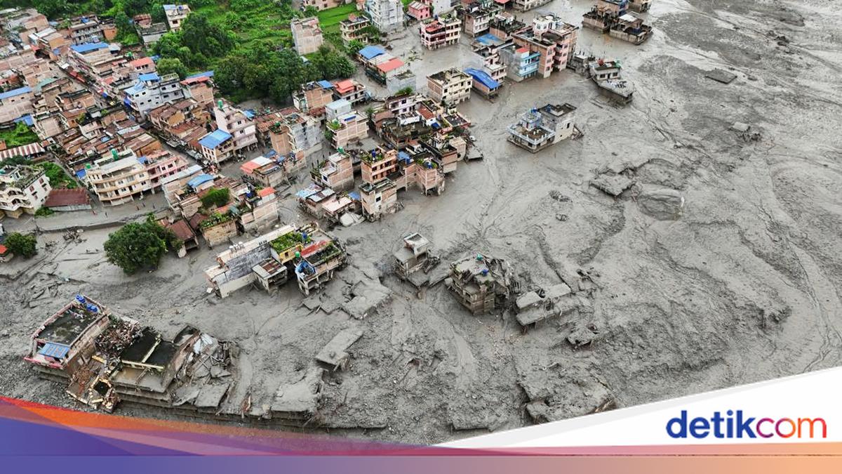
Nepalese and Chinese authorities have both issued warnings of secondary flood risk in the Himalayan region. The warnings were issued because a lake formed on both sides of the Nepal-Tibet border as a result of an earlier landslide has the potential to burst and send a torrent of water into areas already struck by a devastating flash flood this week.
Search and rescue operations are still ongoing in valley areas and hillsides filled with debris, with more than 1,400 people still reported missing following the flash flood that struck the Nepal-Tibet border region on Wednesday morning (26/8).
The latest data indicates that at least 472 people have died as a result of the catastrophic disaster, comprising 469 fatalities in Nepal and three in Tibet.
More than 1,400 others, including hundreds of foreign nationals from dozens of countries, are reported missing in Nepal. A separate report from Chinese state television CCTV stated that 558 people are missing in the Gyirong area of Tibet, including 260 foreign nationals.
Both Nepal and China have stated that the flash flood was caused by a glacier collapse that triggered a rapid flow of rocks, ice material, mud and debris that swept through the Himalayan mountain river system.
Climate change is believed to be causing glaciers to melt worldwide, thereby increasing the risk of glacial lake floods and glacier collapses.
Nepal’s disaster management authority, as reported by Reuters and AFP on Friday (28/8/2026), issued a warning stating that the water level in a lake, formed by debris damming a river at the flood-stricken site, is rising and at risk of bursting.
“Residents on the lower banks… passengers, rescue workers involved in rescue operations, and all relevant parties are urged to exercise extreme caution and remain in safe locations, away from riverbanks and at-risk areas,” read the warning issued by Nepalese authorities on Thursday (27/8).
Chinese authorities, through state media CCTV, warned that the lake formed after the landslide struck the China-Nepal border faces a “high risk of bursting and sending floodwaters downstream”.
The water level is expected to rise over the next three days and peak around 1 September. The situation is exacerbated by weather forecasts predicting rain in the region over the next three days.
“Based on forecasts, the volume of water entering the lake could reach approximately 3 million cubic metres over the next three days, amid continuing heavy rain, which increases the risk of the lake bursting and sending floodwaters downstream, potentially causing further damage in various areas, including Gyirong Port and other downstream areas,” read the warning reported by Xinhua news agency late on Thursday (27/8).
The formation of the artificial lake was captured in aerial video taken by Chinese rescue teams on Thursday (27/8) local time. The footage showed a mass of brown water collected in a basin, which appeared to have no outlet.
The body of water was seen submerging shrubs and trees, and appeared to be pressing against the barrier formed by the accumulation of debris and rocks.