
Mount Sinabung Activity Increases, Karo Regency Government Issues Advisory to Residents
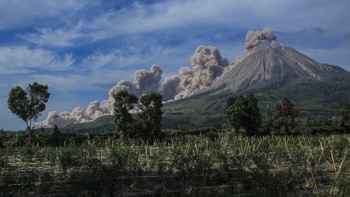
Mount Sinabung in Karo Regency, North Sumatra, has shown an increase in activity. At the beginning of August, the Sinabung Monitoring Post reported that the volcano’s seismicity was dominated by tectonic and volcanic earthquakes, although the numbers were not significant. Based on this information, the Karo Regency Government is urging the public to comply with the designated safety zones. As of 1 August 2026, the Geological Agency of the Ministry of Energy and Mineral Resources raised the volcanic activity status of Mount Sinabung to Alert (Level II).
"This determination is set forth in the Acting Head of the Geological Agency’s Letter Number 1321.Lap/GL/BGL/2026 as a result of monitoring the latest developments," said Karo Regency Secretary Gelora Putra Ginting on Tuesday (4/8). He explained that the status was raised considering the potential danger of eruptions, both phreatic and magmatic, which could occur at any time. In connection with this, all members of the public and visitors are asked to comply with the established safety provisions, namely not conducting activities in villages that have been relocated, as well as areas within a two-kilometre radial radius from the mountain’s peak. Specifically for the southern to eastern sectors, the restricted area extends up to 3.5 kilometres from the peak of Mount Sinabung.
Furthermore, residents living along rivers originating in the mountain area are urged to constantly increase their vigilance against the potential danger of lahars. The Karo Regency Secretary also appealed to the public not to be easily exposed to or spread unverified issues in order to prevent panic within the community. "Always refer to official information conveyed through the website and social media accounts of the Karo Regency Government and the relevant authorities," he said. Currently, the Karo Regency Government is continuously coordinating with the Centre for Volcanology and Geological Hazard Mitigation and the Sinabung Monitoring Post to monitor the situation at all times. Complete information regarding this advisory has also been published through the official Instagram account of the Karo Regency Communication and Informatics Office.
Previously, the Head of the Mount Sinabung Monitoring Post, Armen Putra, stated that seismic monitoring at the end of last week, on 1 August 2026, showed an increase in deep volcanic earthquakes. "In addition, puffing earthquakes, low-frequency earthquakes, and hybrid earthquakes, which were previously rarely recorded, were also detected," said Armen. According to Armen, crater smoke emissions were observed to be thin to moderately thick white, with heights ranging between 50 and 600 metres above the lava dome. "This increase in seismic activity needs to be watched, considering the potential dangers of Mount Sinabung which can occur in the form of phreatic or magmatic eruptions," he explained. The potential for lava dome collapse, Armen added, could also occur if the pressure within the magmatic system increases significantly. "The current activity level of Mount Sinabung is Level II (Alert) since it was lowered from Level III on 17 May 2023," he detailed. Since March 2024, the Centre for Volcanology and Geological Hazard Mitigation has recommended that the public, tourists, and climbers not conduct activities within a 2 km radius from the peak of Mount Sinabung, and a 3.5 km sectoral radius for the south-eastern sector of Mount Sinabung. Besides the direct threat of incandescent rock ejections and ash dispersal, the public is also reminded of the potential secondary hazards of lava flows, especially during the rainy season. Lava flows can traverse rivers in the south-western sector that originate at the peak of Mount Sinabung.