
Mount Semeru Hiking Trails Closed as Volcano Erupts, Forest Fires Spread
Mount Semeru Hiking Trails Closed as Volcano Erupts, Forest Fires Spread
Reporter
September 6, 2026 | 10:14 am
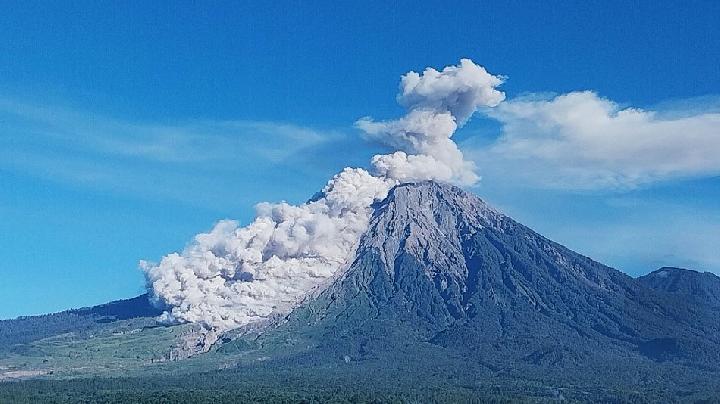
TEMPO.CO, Jakarta - Indonesia’s Mount Semeru erupted in East Java on Sunday morning, sending an ash column 1,000 meters above its summit as forest fires continued to spread across the mountain’s slopes and authorities kept its hiking trails closed.
As reported by Antara, the eruption adds to safety concerns around Java’s highest mountain, where a wildfire has reportedly burned more than 3,000 hectares of forest, according to data from the Bromo Tengger Semeru National Park (TNBTS).
Mount Semeru Erupts With 1,000-Meter Ash Column
Mount Semeru, located on the border of Lumajang and Malang regencies in East Java, erupted at 7:51 a.m. local time on Sunday, September 6, 2026.
Sigit Rian Alfian, an officer at the Mount Semeru Observation Post, said the eruption produced a thick white-to-gray ash column that rose approximately 1,000 meters above the Mahameru peak, reaching an elevation of about 4,676 meters above sea level.
“The eruption was recorded on the seismograph with a maximum amplitude of 23 mm and a duration of 102 seconds,” Sigit said in a written report received in Lumajang.
Republika reported that the ash column drifted eastward as volcanic activity remained at Level III, or Alert.
Under the current alert status, authorities have prohibited outdoor activities in several areas around the volcano because of the risk of hot clouds, lava avalanches, pyroclastic flows and lahars.
Authorities Warn of Pyroclastic Flows and Lava
Sigit urged the public to avoid the southeastern sector along the Besuk Kobokan River within 13 kilometers of the summit, which is the eruption’s epicenter.
People are also prohibited from conducting activities within 500 meters of the Besuk Kobokan riverbanks beyond the 13-kilometer zone because hot clouds and lava flows could travel as far as 17 kilometers from the summit.
In addition, activities are prohibited within a five-kilometer radius of Mount Semeru’s crater or summit because of the risk of incandescent rocks being ejected during eruptions.
According to Republika, Sigit also warned of potential pyroclastic flows, lava avalanches and lava along river channels and valleys originating from the summit, particularly Besuk Kobokan, Besuk Bang, Besuk Kembar and Besuk Sat.
Smaller streams connected to Besuk Kobokan could also carry lahars, requiring residents and visitors to remain alert.
Forest Fires Spread Across Mount Semeru
The eruption occurred as forest fires continued to burn on Mount Semeru.
Data from TNBTS cited by both Republika and Antara showed that more than 3,000 hectares of forest had been affected by the fires.
The blaze remained unextinguished as of Sunday morning and was reportedly spreading further across the mountain’s slopes.
The fires have added another layer of risk to an area already subject to volcanic hazards. Earlier reports indicated that difficult terrain and steep slopes have complicated firefighting operations around Semeru.
Mount Semeru Hiking Trails Remain Closed
The TNBTS authorities have closed hiking trails to Mount Semeru because of the forest and land fires on its slopes.
The closure was imposed to protect hikers and support firefighting operations. Antara previously reported that all 170 hikers who were on Mount Semeru when the fire broke out had been safely evacuated, after the blaze approached the main trekking route.
The trail closure is part of wider efforts to reduce wildfire risks in Indonesia’s national parks. The Ministry of Forestry announced temporary hiking restrictions at several national parks after fires affected protected areas, including the Mount Semeru area.
With Semeru remaining at Alert status and fires continuing to spread, authorities are urging the public to follow safety restrictions and stay away from designated danger zones around the volcano.
Read: Mount Anak Krakatau Volcanic Ash Forces Temporary Closure of Soekarno-Hatta Airport
Click here to get the latest news updates from Tempo on Google News