Mount Semeru Erupts with Pyroclastic Flows, Runout Distance Unclear
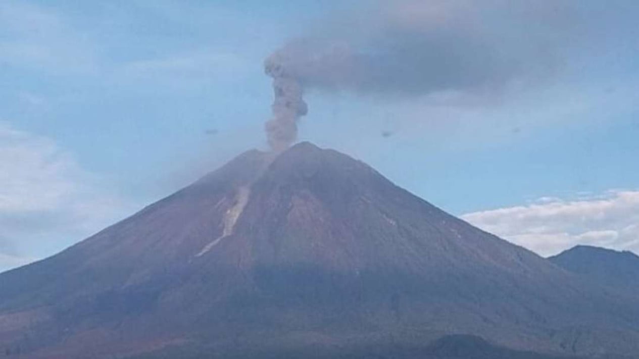
Mount Semeru erupted with pyroclastic flows on Wednesday afternoon, with the runout distance unknown due to fog obscuring visibility. The volcano is located on the border of Lumajang and Malang regencies in East Java. Sigit Rian Alfian, a monitoring post officer at Mount Semeru, stated that the eruption was recorded on seismograms with a maximum amplitude of 23 mm and a duration of approximately three minutes and 29 seconds. ‘A Mount Semeru eruption occurred at 11:22 WIB, but the ash column height could not be observed due to fog,’ he said in a written report received in Lumajang on 27 May 2027. According to monitoring data, Mount Semeru experienced seven eruptions between 00:14 and 11:22 WIB, with eruption heights ranging from 600 to 800 metres above the summit. ‘The eruptions consisted of pyroclastic flows with an unknown runout distance due to the mountain being obscured by fog,’ he added. He explained that volcanic activity is currently at Level III (Alert), with recommendations for residents not to engage in any activities in the southeast sector along the Besuk Kobokan river within 13 km from the summit (eruption centre). ‘Beyond that distance, residents must also refrain from activities within 500 metres of the riverbanks along the Besuk Kobokan due to the potential for pyroclastic flow expansion and lahar flows extending up to 17 km from the summit,’ he said. Residents are also prohibited from activities within a 5 km radius of the crater/summit of Mount Semeru due to the risk of rock ejections (incandescent material). The public is urged to remain vigilant for potential pyroclastic flows, lava rockfalls, and lahars along all river valleys originating from the summit of Mount Semeru. ‘Especially along the Besuk Kobokan, Besuk Bang, Besuk Kembar, and Besuk Sat rivers, as well as potential lahars in smaller tributaries of the Besuk Kobokan,’ he added.