
Mount Semeru Erupts Three Times This Morning, Launching Ash Up to 1,000 Metres
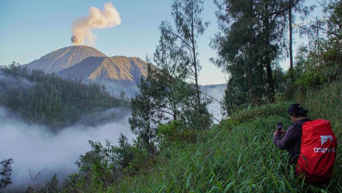
Mount Semeru, located on the border of Lumajang and Malang Regencies, East Java, experienced three eruptions on Monday (14/9) morning. The third eruption was the largest, with a volcanic ash column reaching 1,000 metres above the peak, or approximately 4,676 metres above sea level (masl).
Sigit Rian Alfian, an officer at the Mount Semeru Observation Post, stated that the first eruption occurred at 04:20 WIB. At that time, the eruption column was observed at a height of 500 metres above the peak, or 4,176 masl.
“The ash column was observed to be white to grey with thick intensity towards the northwest. The eruption was recorded on the seismograph with a maximum amplitude of 21 mm and a duration of 128 seconds,” said Sigit Rian Alfian in a written report received in Lumajang on Monday.
The next eruption occurred approximately one and a half hours later, specifically at 05:53 WIB. The height of the eruption column increased to 800 metres above the peak, reaching 4,476 masl.
During this second eruption, the ash column was grey with thick intensity, moving towards the north and northwest. This activity was recorded on the seismograph with a maximum amplitude of 23 mm and a duration of 133 seconds.
Shortly thereafter, a third eruption occurred at 06:28 WIB. The volcanic ash column was observed reaching 1,000 metres above the peak, at an altitude of approximately 4,676 masl.
“The ash column was observed to be grey with thick intensity towards the east. The eruption was recorded on the seismograph with a maximum amplitude of 23 mm and a duration of 140 seconds,” he said.
Sigit stated that the volcanic activity of Mount Semeru is currently still at Level III (Alert). The public is requested to comply with safety recommendations and refrain from any activities in areas potentially affected by the eruptions.
Residents are prohibited from conducting activities in the southeastern sector from Besuk Kobokan up to 13 kilometres from the peak, which serves as the centre of the eruption.
“Outside of that distance, the public must also avoid activities within 500 metres of the riverbanks along Besuk Kobokan, due to the potential for expanding hot clouds and lava flows up to 17 km from the peak,” he added.
Furthermore, public activity is restricted within a 5-kilometre radius of the crater or the peak of Mount Semeru, as the area is prone to being hit by flying incandescent rocks.
Sigit also reminded residents to remain vigilant regarding the potential for hot clouds, lava flows, and lahars that may occur along the rivers and valleys originating from the peak of Semeru.
“Particularly along Besuk Kobokan, Besuk Bang, Besuk Kembar, and Besuk Sat, as well as the potential for lahars in small rivers that are tributaries of Besuk Kobokan,” he said.
Source: jawawa.id (https://jawawa.id/newsitem/mount-semeru-erupts-three-times-this-morning-launching-ash-up-to-1-000-metres-1789354690)
Originally published by CNN Indonesia (https://www.cnnindonesia.com/nasional/20260914081734-20-1403537/gunung-semeru-3-kali-erupsi-pagi-ini-lontarkan-abu-hingga-1000-meter), translated from Indonesian