
Mount Semeru Erupts, Spewing Ash 900 Metres High
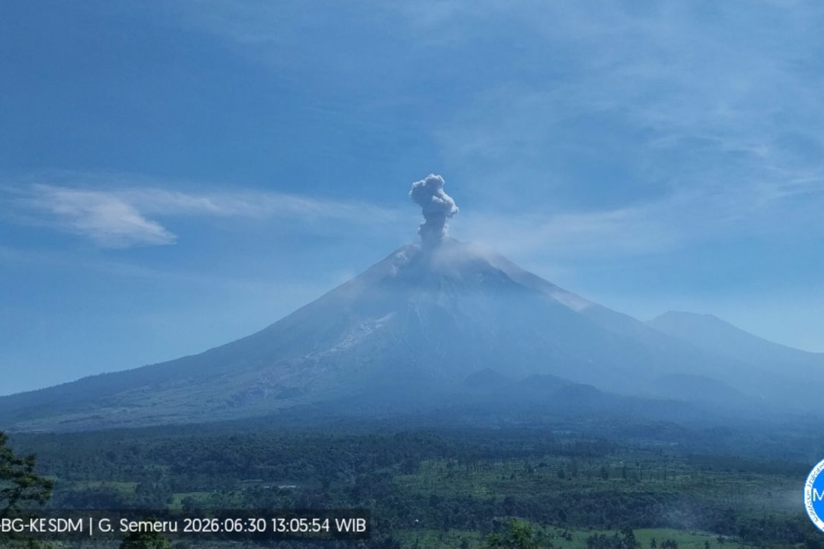
Mount Semeru, located on the border of Lumajang and Malang regencies in East Java, erupted on Tuesday afternoon, producing an ash column observed at 900 metres above the peak. The eruption occurred at 13.04 WIB, with the column reaching an altitude of 4,576 metres above sea level, according to a written report from Mount Semeru Observation Post officer Sigit Rian Alfian. The eruption was recorded on a seismograph with a maximum amplitude of 21 mm and a duration of 99 seconds. According to records, the highest mountain on Java Island has erupted five times on Tuesday, from 00.16 WIB to 13.04 WIB, with eruption heights ranging from 500 to 900 metres above the summit. Sigit explained that the volcanic activity of Mount Semeru is currently at Status Level III (Alert), with a recommendation for the public not to conduct any activities in the southeast sector along Besuk Kobokan, up to 13 kilometres from the summit. Beyond that distance, the public is advised not to carry out activities within 500 metres of the riverbank along Besuk Kobokan, due to the potential for expansion of pyroclastic clouds and lava flows up to 17 kilometres from the peak. The public is prohibited from activities within a five-kilometre radius of the crater or summit of Mount Semeru, as it is prone to the danger of ejected incandescent rocks. He urged the public to be aware of the potential for pyroclastic clouds, lava avalanches, and lahars along river valleys originating at the summit of Mount Semeru, particularly along Besuk Kobokan, Besuk Bang, Besuk Kembar, and Besuk Sat, as well as the potential for lahars in small streams that are tributaries of Besuk Kobokan.