
Mount Semeru Erupts, Spewing Ash 1,000 Metres Above Summit
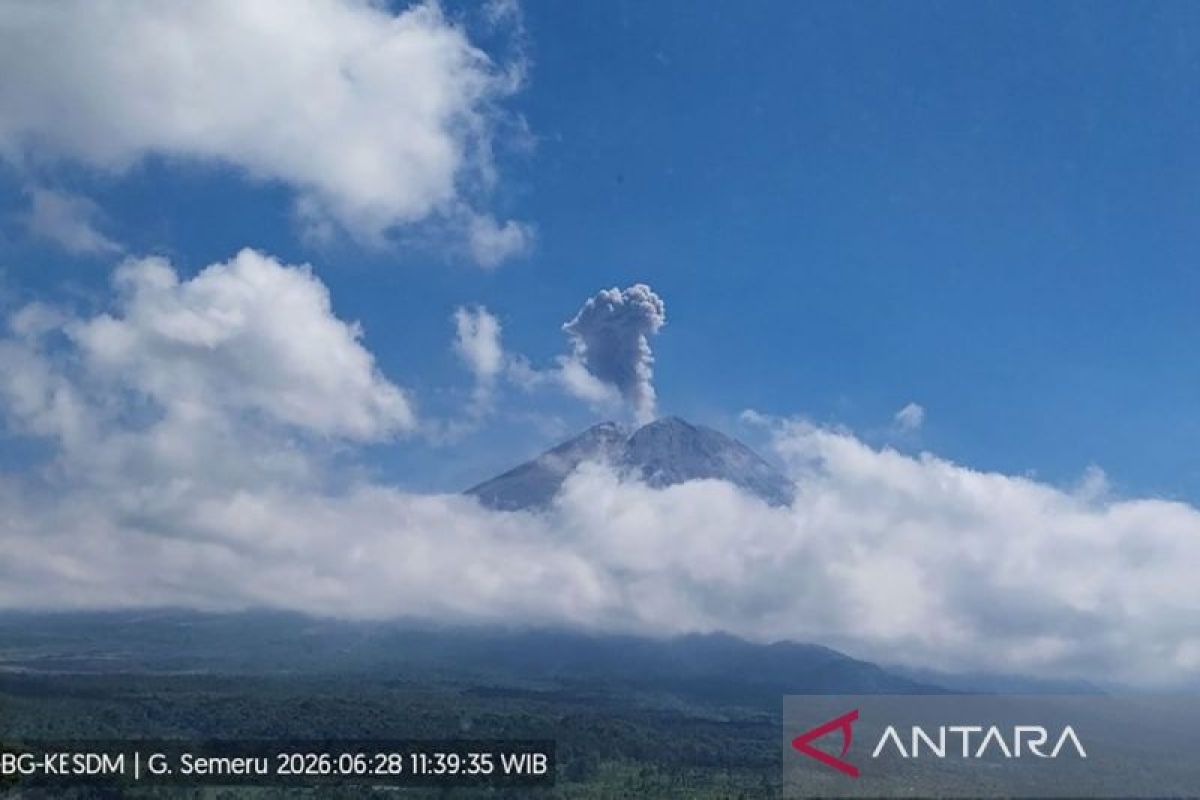
Lumajang, East Java - Mount Semeru, located on the border of Lumajante and Malang Regencies, East Java, erupted with an eruption height reaching 1,000 metres above the peak on Sunday afternoon.
“An eruption of Mount Semeru occurred at 11:37 WIB, with the eruption column observed at approximately 1,000 metres above the peak, or 4,676 metres above sea level (masl),” stated Mukdas Sofian, an officer at the Mount Semeru Observation Post, in a written report in Lumajang on Sunday.
During the eruption, the ash column was observed to be white to grey in colour with thick intensity, drifting towards the southeast and south. The eruption was recorded on the seismograph with a maximum amplitude of 22 mm and a duration of 170 seconds.
Earlier, at 06:32 WIB, another eruption occurred with an eruption column height of approximately 500 metres above the peak, with white to grey ash drifting towards the northwest. This eruption was recorded on the seismograph with a maximum amplitude of 22 mm and a duration of 129 seconds.
A third eruption occurred at 09:11 WIB, though the visual eruption could not be observed. It was recorded on the seismograph with a maximum amplitude of 22 mm and a duration of 203 seconds, followed by the 11:37 WIB eruption reaching 1,000 metres above the peak.
Currently, the volcanic activity of Mount Semeru is at Level III (Alert) status. Authorities have recommended that the public refrain from any activities in the southeastern sector along Besuk Kobokan, within 13 kilometres of the peak (the centre of the eruption).
Outside of that range, he stated, the public should avoid activities within 500 metres of the riverbanks along Besuk Kobokan due to the potential for expanding pyroclastic clouds and lava flows up to 17 kilometres from the peak.
“The public is prohibited from conducting activities within a five-kilometre radius of the crater/peak of Mount Semeru, as it is prone to the danger of volcanic rock fragments (incandescent debris),” he said.
He urged the public to remain vigilant regarding the potential for pyroclastic clouds, lava flows, and lahars along the rivers and valleys originating from the peak of Mount Semeru.
“Particularly along Besuk Kobokan, Besuk Bang, Besuk Kembar, and Besuk Sat, as well as the potential for lahars in small rivers that are tributaries to Besuk Kobokan,” he added.