
Mount Semeru Erupts, Eruption Column Reaches 1,000 Metres Above Peak
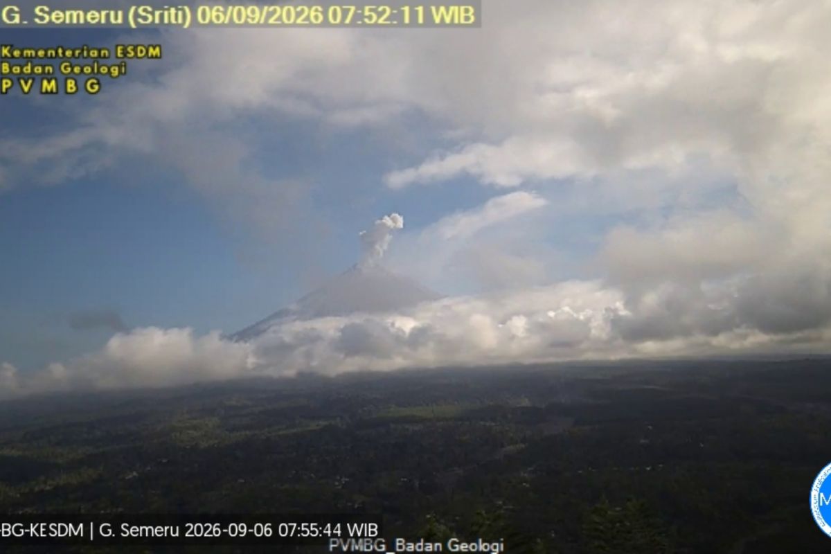
Lumajang, East Java - Mount Semeru, located on the border of Lumajang and Malang Regencies, East Java, underwent an eruption with an explosion reaching 1,000 metres above the Mahameru peak on Sunday morning.
“An eruption of Mount Semeru occurred at 07:51 WIB, with the observed eruption column height at approximately 1,000 metres above the peak, or 4,676 metres above sea level (masl),” stated Sigit Rian Alfian, an officer at the Mount Semeru Observation Post, in a written report received in Lumajang, East Java, on Sunday.
Sigit explained that the current volcanic activity of Mount Semeru is at Level III, or Alert status. He detailed that the observed ash column was white to grey in colour with thick intensity, moving towards the east.
“The eruption was recorded on the seismograph with a maximum amplitude of 23 mm and a duration of 102 seconds,” he said.
Due to the Alert status, the public is advised against outdoor activities, particularly in the south-eastern sector along Besuk Kobokan, up to 13 km from the peak which is the centre of the eruption.
“Outside of that distance, the public must also refrain from activities within 500 metres of the riverbanks along Besuk Kobokan, as there is a potential for the expansion of hot clouds and lava flows up to 17 km from the peak,” Sigit added.
Furthermore, the public is prohibited from any activities within a 5 km radius of the Mount Semeru crater/peak due to the danger of volcanic rock fragments (pyroclastic material).
Sigit urged the community to remain vigilant regarding the potential for hot clouds, lava flows, and lahars along the river flows or valleys originating from the peak of Mount Semeru.
“Particularly along Besuk Kobokan, Besuk Bang, Besuk Kembar, and Besuk Sat, as well as the potential for lahars in small rivers that are tributaries of Besuk Kobokan,” said Sigit.
On the other hand, this volcanic activity coincides with ongoing forest fires on Mount Semeru which, as of Sunday morning, have yet to be extinguished, with fire hotspots continuing to expand.
According to data from the Bromo Tengger Semeru National Park (TNBTS), the area of burnt forest has reached more than 3,000 hectares.
The hiking trails to the highest mountain on Java island have also been closed by the TNBTS Grand Office due to the forest and land fires on the slopes of Semeru.