
Mount Semeru Erupts Again, Alert Status Raised to Level III
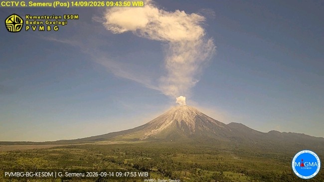
Jakarta, CNBC Indonesia — The Geological Agency of the Ministry of Energy and Mineral Resources (ESDM) reported that Mount Semeru in East Java erupted on Friday, 9 October 2026, at 4.03am Western Indonesian Time (WIB).
The ash column was observed reaching approximately 700 metres above the summit, or 4,376 metres above sea level. “The ash column was white to grey, dense and drifting north. The eruption was recorded on a seismogram with a maximum amplitude of 19 mm and a duration of approximately 2 minutes and 19 seconds,” the Geological Agency said on Friday (9 October 2026).
“Mount Semeru is currently at Level III (Alert),” it added.
To mitigate the risks, the Geological Agency issued the following recommendations:
Do not carry out any activities in the south-eastern sector along Besuk Kobokan, up to 13 km from the summit (the eruption centre). Beyond that distance, people should stay at least 500 metres from the riverbanks along Besuk Kobokan, as pyroclastic flows and lahars could spread as far as 17 km from the summit.
Do not enter within a 5 km radius of the Mount Semeru crater or summit, due to the risk of being struck by incandescent rocks.
Be alert to the potential for pyroclastic flows, lava avalanches and lahars along rivers and valleys originating at Mount Semeru’s summit, particularly Besuk Kobokan, Besuk Bang, Besuk Kembar and Besuk Sat, as well as the risk of lahars in small tributaries of Besuk Kobokan.
Source: jawawa.id (https://jawawa.id/newsitem/mount-semeru-erupts-again-alert-status-raised-to-level-iii-1791525069)
Originally published by CNBC Indonesia (https://www.cnbcindonesia.com/news/20261009111732-4-774688/gunung-semeru-erupsi-lagi-status-naik-ke-level-iii-siaga), translated from Indonesian