
Mount Semeru activity still dominated by eruptions and volcanic earthquakes
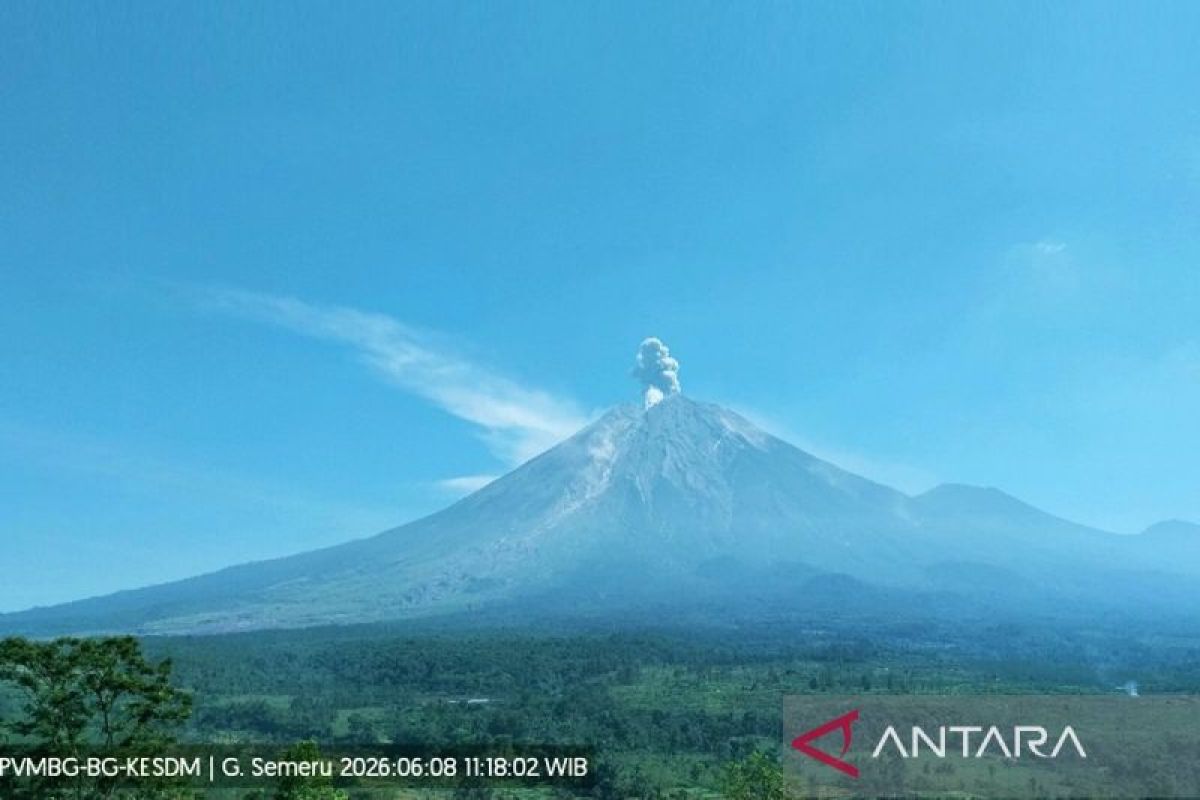
The volcanic activity of Mount Semeru, which stands at 3,676 metres above sea level, continued to be dominated by eruptions and volcanic earthquakes on Monday (8/6).
“Sixteen eruption earthquakes with amplitudes of 13-22 mm and durations of 69-122 seconds were recorded on Monday during the six-hour period from 06:00 to 12:00 WIB,” stated Sigit Rian Alfian, an officer at the Mount Semeru Observation Post, in a written report received in Lumajang.
Semeru also experienced four collapse earthquakes with amplitudes of 2-3 mm and durations of 31-110 seconds, two inflation earthquakes with amplitudes of 2-6 mm and durations of 30-59 seconds, and five distant tectonic earthquakes with amplitudes of 13-39 mm.
Visually, the peak of Mount Semeru was clearly visible despite some fog, with white and grey smoke observed rising from the main crater at low to moderate intensity, approximately 100-300 metres above the summit. The weather was reported as clear with light winds blowing towards the west and northwest.
Sigit explained that the highest mountain on Java Island recorded five eruptions since 05:25 WIB, with ash column heights observed at approximately 300 metres above the summit. The fifth eruption occurred at 11:16 WIB, with the eruption column reaching approximately 700 metres above the summit, or 4,376 metres above sea level.
Currently, Mount Semeru’s volcanic activity is at Alert Level III (Siaga). Authorities have recommended that the public refrain from any activities in the south-eastern sector along Besuk Kobokan, within a 13-kilometre radius of the eruption centre.
Outside of that specific zone, the public is advised to avoid activities within 500 metres of the riverbanks along Besuk Kobokan due to the potential for expanding pyroclastic clouds and lava flows extending up to 17 kilometres from the summit. Furthermore, activities are strictly prohibited within a five-kilometre radius of the crater/summit of Mount Semeru due to the danger of volcanic rock fragments.
Residents are urged to remain vigilant regarding the potential for hot clouds, lava flows, and lahars along the riverbeds and valleys originating from the summit, particularly along Besuk Kobokan, Besuk Bang, Besuk Kembar, and Besuk Sat, as well as potential lahars in small tributaries of Besuk Kobokan.