
Mount Lewotolok Activity Increases After NTT Earthquake, Danger Radius Extended to 3 km
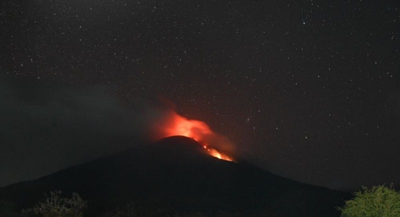
Volcanic activity at Mount Ili Lewotolok in Lembata Regency, East Nusa Tenggara (NTT), has increased after a 7.7-magnitude earthquake shook the region on Saturday (15/8). The Geological Agency has subsequently expanded the recommended danger radius in the southern and south-eastern sectors of the volcano to 3 kilometres.
The increase in activity is marked by lava flows emerging from the crater towards the southern sector. Based on visual monitoring on Tuesday (18/8), the lava flow, which previously reached around 400 metres, has continued to advance to approximately 1,200 metres from the crater rim.
“Based on visual and instrumental monitoring data, Mount Ili Lewotolok is showing increased volcanic activity, particularly lava flow activity,” said Head of the Geological Agency Lana Saria in her report on Wednesday (19/8).
The volcano, located in Ile Ape District, remains at Waspada (Alert) status. The increase in activity occurred after the Flores earthquake and was followed by an increase in local and distant tectonic earthquakes.
On 18 August until 18.00 WITA, 113 eruption earthquakes, 12 blast earthquakes, 31 non-harmonic tremors, one hybrid/multi-phase earthquake, three shallow volcanic earthquakes, and three distant tectonic earthquakes were recorded. Continuous tremor was also recorded with a dominant amplitude of 16.6 millimetres.
In addition to lava flows, incandescent material ejections were observed reaching 100-500 metres towards the south-east and 100-400 metres towards the south. The eruption was also accompanied by rumbling or booming sounds with weak to strong intensity.
With this increase in activity, the Geological Agency has asked residents, visitors, hikers, and tourists not to enter or conduct activities within a 2-kilometre radius from the centre of Mount Ili Lewotolok’s activity. Specifically for the southern and south-eastern sectors, the recommended distance has been extended to 3 kilometres.
“Residents around Mount Ili Lewotolok as well as visitors/hikers/tourists should not enter and should not conduct activities within a 2-kilometre radius from the centre of the volcano’s activity and 3 kilometres in the southern and south-eastern sectors,” said Lana.
The public has also been asked to be aware of the potential danger of lava avalanches or landslides and pyroclastic flows in the southern and south-eastern sectors, the western sector, and the north-eastern sector of the volcano.
In addition, residents around the volcano are advised to wear protective masks for the mouth and nose as well as equipment to protect the eyes and skin to avoid respiratory problems and other health issues due to exposure to volcanic ash.
Lana urged the public not to panic when hearing rumbling or booming sounds from the crater as this is part of the volcanic activity of an erupting volcano.
Meanwhile, eruption data for Mount Lewotolok released by PVMBG stated that during Tuesday, 18 August, the volcano experienced 158 eruptions with heights of 100-500 metres.
The eruptions were accompanied by incandescent material ejections and booming or rumbling sounds. Lava flows also continued to move towards the southern sector to approximately 1,200 metres from the crater rim. Continuous tremor was still recorded with a dominant amplitude of 16.6 millimetres.