
Mount Karangetang Erupts, Residents Urged to Avoid Danger Zone
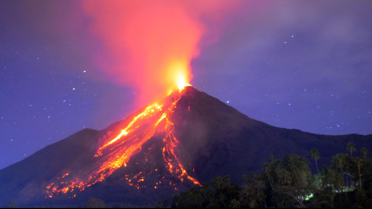
Mount Karangetang in the Siau Tagulandang Biaro (Sitaro) Regency of North Sulawesi erupted on Sunday evening (12 July).
“Based on information from the Centre for Volcanology and Geological Hazard Mitigation (PVMBG), the eruption began with a Strombolian-type eruption (weakly explosive) reaching about 100 metres in height, accompanied by a booming sound, with incandescent material falling around the crater,” said Abdul Muhari, Head of Disaster Data, Information and Communication at BNPB, in an official statement on Monday (13 July).
Muhari said the activity at Mount Karangetang occurred at around 19:14 Central Indonesian Time on Sunday (12 July), followed by an effusive eruption in the form of lava flows travelling 1,000 metres northwards from the main northern crater, 400 metres towards the west-southwest, and 1,000 metres towards the south.
“The Sitaro Regency BPBD’s observations last night showed that hot material ejected from the eruption set fire to reeds around the summit, and the flames were reflected above the mist so that it appeared like a large fire,” he said.
Then today, Muhari said, the local BPBD reported a blaze in the reeds around the mountain’s peak, but it was successfully extinguished.
“Sitaro Regency BPBD personnel remain on standby to monitor natural dynamics and weather conditions to minimise the potential for forest and land fires resulting from the volcanic eruption. The local government has also issued an advisory letter urging residents to remain vigilant about possible natural developments,” he explained.
Daily community activities today were reported to be continuing as normal. The volcano’s status also remains at Level II, or alert.
Mount Karangetang, which stands 1,784 metres above sea level, has shown increased activity since the beginning of July this year. During the period of 1 to 11 July, 12 avalanche earthquakes, 83 blow earthquakes, 7 harmonic tremors, 32 non-harmonic tremors and 10 hybrid/multiphase earthquakes were recorded.
These were followed by 41 shallow volcanic earthquakes, 21 deep volcanic earthquakes, 3 local tectonic earthquakes, 4 felt earthquakes at I-III MMI intensity, and 127 distant tectonic earthquakes.
“Given this level of activity, PVMBG states that the activity level remains at Level II, or alert. The volcano’s activity status has not changed since 11 January 2025,” he said.
BNPB has urged communities living in disaster-prone areas to comply with the recommendations issued by the relevant authorities.
“Members of the public and tourists are advised not to approach, not to climb and not to carry out activities within the predicted danger zone, namely a radius of 1.5 km from the peak of Crater Two (North Crater) and the Main Crater (South), as well as the sectoral extension area towards the south-southwest extending 2.5 km,” he said.
In addition, Muhari asked residents living near rivers originating from the summit of Mount Karangetang to increase their preparedness against the potential threat of rain-triggered lahars and flash floods that could flow all the way to the coast.
“Also remain vigilant for lava avalanches and pyroclastic density currents that could occur at any time from the accumulation of previous lava material, as its condition remains unstable and prone to collapse, especially towards the southern, southeastern, western and southwestern sectors,” he said.