
Minister AHY is Correct: Indonesia's Condition is Already Critical
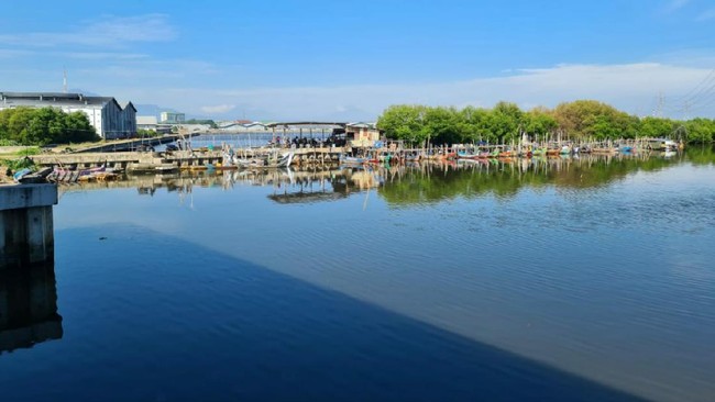
Several areas along the northern coast of Java are facing the risk of future flooding due to land subsidence and rising sea levels. The rate of sea-level rise varies between approximately 2.4 to 4.3 millimetres (mm) per year, affecting coastal regions including Jakarta, Bekasi, Indramayu, Cirebon, Subang, Pemalang, Pekalongan, and Demak.
Agung Syetiawan, an expert researcher at the National Research and Innovation Agency (BRIN), explained that coastal observations were conducted using various geodetic and remote sensing approaches. The use of Interferometric Synthetic Aperture Radar (InSAR), Global Navigation Satellite System (GNSS), terrestrial observations, and multi-data geospatial modelling played a vital role in mapping deformation dynamics in these coastal areas.
“GNSS observation data obtained from the Indonesia Continuously Operating Reference Station [InaCORS] also shows a vertical deformation pattern that tends to be non-linear in most parts of the northern coast (Pantura). This data is used to validate the results of Synthetic Aperture Radar (SAR) satellite observations,” said Agung, as quoted from the BRIN website on Tuesday (2/6/2026).
A primary factor driving land subsidence in coastal areas is the exploitation of groundwater. Agung noted that the demand for clean water and aquaculture activities, such as vaname shrimp farming, has increased pressure on groundwater reserves.
Using simple bathtub modelling, several coastal areas are also at risk of permanent inundation if appropriate mitigation is not implemented. Furthermore, expanding areas of flooding have been identified in the Muara Gembong area as well as several coastal parts of Jakarta, Tangerang, and Bekasi, caused by the combination of land subsidence and rising sea levels.
Agung urged that comprehensive geospatial studies must be considered when constructing mitigation infrastructure, such as a giant sea wall, to ensure precise interventions. Additionally, geospatial-based policies are deemed essential to support sustainable coastal development, including the regulation of boreholes, mangrove rehabilitation, and the evaluation of sea wall construction.
“Save water, save life; the clean water we save today is the breath of life for future generations,” he added.
The critical condition of the northern coast was previously highlighted by the Coordinating Minister for Infrastructure and Regional Development, Agus Harimurti Yudhoyono (AHY). The urgency prompted AHY to convene Indonesian officials, including the Head of the Java Northern Coast Management Authority (BOPPJ) Didit Herdiawan Ashaf, several deputy ministers, agency representatives, and regional heads on Monday (4/5/2026).
AHY revealed that the Java northern coast is currently in a concerning state due to increasing disaster potential. Every year, land subsidence reaches 15 to 20 cm, while the northern coast also faces rising sea levels due to global warming, with sea levels rising by 0.8 cm to 1.2 cm per year.
“This results in the persistent threat of tidal flooding (rob) which can destroy property, damage residents’ homes, and more,” he stated.
AHY warned that without serious intervention, seawater inundation in the northern coast by 2050 could be far more severe. In addition to tidal flooding, coastal communities are also beginning to face the threat of a clean water crisis.