
Military Exercise Turns Tragic as Plane Crashes into Mountain
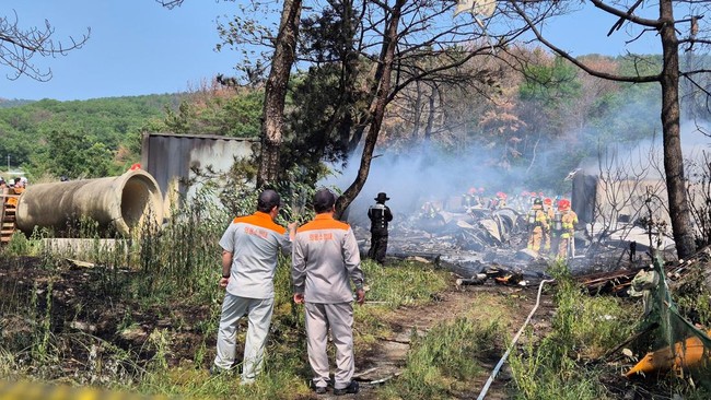
Four people died after the air ambulance they were travelling in crashed into a mountainside in New Mexico, United States, on 13 May. A preliminary report from the National Transportation Safety Board (NTSB) has linked the accident to a US military exercise that disrupted GPS signals in the region.
The NTSB revealed that the military’s GPS signal jamming exercise interfered with the navigation systems of several civilian aircraft. This left air traffic controllers overwhelmed as they attempted to reroute flights using conventional navigation methods.
‘The signal jamming exercise disrupted a number of aircraft,’ the NTSB stated, describing the increasingly complex air traffic situation at the time of the incident.
The Beechcraft King Air 90, carrying two pilots and two nurses, was originally on a medical evacuation mission from Roswell to Sierra Blanca Regional Airport. The crew was tasked with picking up a patient before flying on to Albuquerque.
Minutes after take-off, the pilot reported a loss of GPS signal and was found to be flying approximately 1,000 feet above the assigned altitude. The air traffic controller then instructed the aircraft to change course while simultaneously requesting the military to temporarily halt the jamming exercise.
At the same time, roughly 64 kilometres from the aircraft’s position, the US Air Force was conducting its annual NAVFEST exercise at the White Sands Missile Range. The activity, involving various electronic warfare units, the defence industry, and NATO countries, had been preceded by a Federal Aviation Administration warning that it could potentially disrupt GPS signals within a radius of up to 640 kilometres between 12 and 18 May.
However, the situation in the control room grew more complicated as controllers also had to manage at least four other aircraft that had lost their GPS signals. As a result, the navigational vectoring promised to the air ambulance was never provided.
When the pilot spotted the lights of Sierra Blanca Airport in the distance, they decided to make a visual approach, unaware of the 10,000-foot Capitan Mountain directly in their flight path. The NTSB noted that the aircraft then began its descent with the altimeter still reading approximately 600 feet higher than its actual position.
As the mountain loomed ahead, the pilot attempted to gain altitude but failed to avoid the collision. The aircraft ultimately slammed into the mountainside, killing everyone on board and sparking a forest fire that took nearly a month to extinguish.
The US Army has yet to provide a response or issue an official statement regarding the incident. Meanwhile, the NTSB has stressed that the investigation is ongoing and the definitive cause of the accident will only be determined once the inquiry is completed next year.