
Megathrust Earthquake Generated an 8-Metre Tsunami that Struck Pangandaran Coast
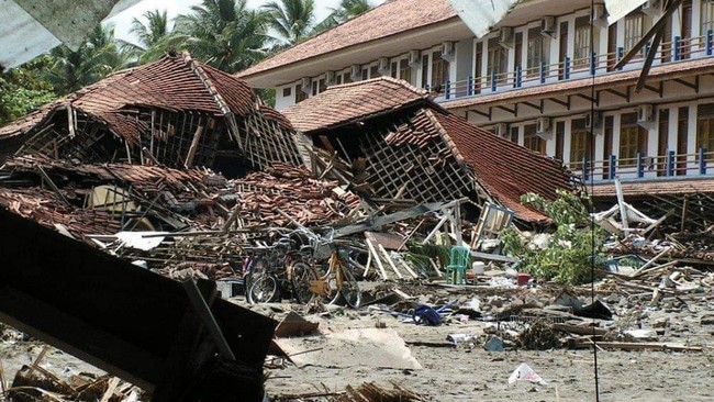
Jakarta, CNBC Indonesia — The National Research and Innovation Agency (BRIN) recently published findings from a study of the 2006 Pangandaran tsunami. One finding suggests that the disaster may have resulted from a highly complex process and had far greater force than previously estimated.
Wiko Setyonegoro, a researcher at BRIN’s Deep Sea Research Centre (PRLD), said the disaster 20 years ago was an example of a “tsunami earthquake” — a situation in which tsunami waves are much larger than estimates based on the recorded earthquake parameters.
“The Pangandaran tsunami is one example of a tsunami earthquake, in which the resulting waves are much larger than estimates based on the parameters of the recorded earthquake,” Wiko said at the Deep-Sea Science Forum webinar, “Towards Deep Sea Mission 2045”, held on Tuesday (4 August), as quoted on Sunday (15 November 2026).
He also presented research into the potential for short-range tsunamis caused by megathrust earthquakes south of Java, using the Pangandaran tsunami as a case study.
The tsunami at the time is thought to have been triggered not solely by seismic activity; non-seismic factors may also have contributed.
Research has found that the 2006 tsunami waves reached more than eight metres. Survivors have said the water rose above the tops of coconut trees along the coast.
“After testing various scenarios, we found that the earthquake and underwater mass movement may both have contributed to generating the tsunami. This model can provide an estimate closer to the actual conditions of the tsunami,” Wiko explained.
The research team tested the hypothesis by assimilating bathymetric and topographic data, historical earthquake catalogues and various field observations. Simulations used a nested-grid system capable of producing high-resolution tsunami models and mapping inundation down to building scale.
The scenarios were tested through iterative calibration to identify the model that best matched the conditions of the disaster.
The evaluation found that a model combining an earthquake source with indications of underwater mass movement was the closest match to field observations. This was reflected in its alignment with wave heights, tsunami arrival times, and levels of exposure affecting infrastructure and casualties.
The study also found that underwater mass movement could accelerate the tsunami’s arrival. In initial simulations without this factor, waves arrived around 40–50 minutes after the earthquake; when underwater mass movement was included, that fell sharply to 20–30 minutes.
The simulations also mapped where the water struck. The waves did not only hit coastal areas but travelled inland through the mouth of the Serayu River in Cilacap.
The same model also identified several areas that remained safe and were not affected by the inundation. The findings could provide an important reference for determining evacuation zones in the future.
Source: jawawa.id (https://jawawa.id/newsitem/megathrust-earthquake-generated-an-8-metre-tsunami-that-struck-pangandaran-coast-1794725460)
Originally published by CNBC Indonesia (https://www.cnbcindonesia.com/tech/20261115093136-37-785324/gempa-megathrust-bangkitkan-tsunami-8-meter-hantam-pesisir-pangandaran), translated from Indonesian