
Megathrust Earthquake Brought Tsunami Over 8 Metres Sweeping Pangandaran Coast
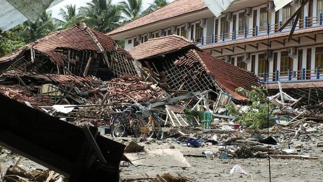
A study conducted by the National Research and Innovation Agency (BRIN) indicates that the mechanism behind the 2006 Pangandaran tsunami was likely more complex than previously understood. In addition to being triggered by an earthquake, the tsunami is suspected to have been influenced by submarine mass movement that amplified wave formation and accelerated the tsunami’s arrival time on the coast.
The Pangandaran tsunami is one example of a tsunami earthquake, a condition in which the resulting tsunami waves are far larger than estimates based on recorded earthquake parameters, said Wiko Setyonegoro, a researcher at BRIN’s Deep Sea Research Centre, during a webinar held on Tuesday (4/8/2026) and cited on Sunday (23/8/2026).
According to him, several studies show wave heights in some locations reached more than 8 metres, with survivor accounts stating that waves exceeded the height of coconut trees in several coastal areas.
After conducting various investigations and analyses, there is potential evidence that non-seismic factors contributed to the tsunami’s amplification on land, Wiko said while presenting his research on short-range tsunami potential triggered by megathrust earthquakes south of Java, using the 2006 Pangandaran tsunami as a case study.
Wiko explained that the Pangandaran tsunami has long been known as a tsunami earthquake, a phenomenon in which the generated tsunami waves are far larger than the measured earthquake source parameters. This condition suggests that the tsunami generation mechanism likely did not originate solely from earthquake-induced deformation but also involved non-seismic factors that require further study.
After testing various scenarios, there is a possibility that the earthquake and submarine mass movement jointly contributed to generating the tsunami. This model is able to provide estimates that more closely match the actual tsunami conditions that occurred, Wiko explained.
To test this hypothesis, the research team assimilated bathymetric data, topography, historical earthquake catalogues, and various field observation data. Simulations were conducted using a nesting grid system to produce high-resolution tsunami modelling and depict inundation areas down to building scale. Various scenarios were then tested through an iterative calibration process to obtain the model most consistent with the 2006 tsunami conditions.
Evaluation of 14 scenarios showed that the model combining the earthquake source with indications of submarine mass movement had the highest level of agreement with field observations. This agreement was evident in wave height, tsunami arrival time, and the level of exposure to infrastructure and casualties.
The study also showed that the presence of submarine mass movement potentially accelerated the tsunami’s arrival. In simulations using only the earthquake source, waves were estimated to reach the coast in about 40-50 minutes. Meanwhile, in the model incorporating submarine mass movement factors, the tsunami was estimated to arrive in about 20-30 minutes, consistent with empirical data from 2006 tsunami survivors.
High-resolution simulations also showed that the tsunami not only struck coastal areas but also entered inland through the mouth of the Serayu River in Cilacap, thereby expanding the affected area. On the other hand, the model was also able to identify several areas that were relatively unaffected by the tsunami, which could potentially be considered in determining future evacuation zones.
In addition to evaluating the tsunami generation mechanism, the research team also tested earthquake source scaling approaches. According to Wiko, the Takemura formulation produced estimates closer to observational data than previously used formulations.
Wiko said these findings are important for improving community preparedness while supporting the development of more accurate disaster mitigation systems, including high-resolution tsunami risk modelling and more affordable tsunami monitoring technology. However, he emphasised that the suspected involvement of submarine mass movement still requires sensitivity analysis and further research to obtain stronger scientific confirmation.
Going forward, BRIN plans to continue ocean hazard research through the development of a more affordable tsunami monitoring system prototype. The technology is designed to monitor sea level changes in real time as part of efforts to strengthen Indonesia’s tsunami early warning system.
We have initiated collaboration with colleagues from the engineering field to produce cheaper tsunami monitoring equipment that can be applied to support ocean wave monitoring, he concluded.