
Mangroves as Coastal Fortress: North Sumatra Drafts Long-Term Management Strategy
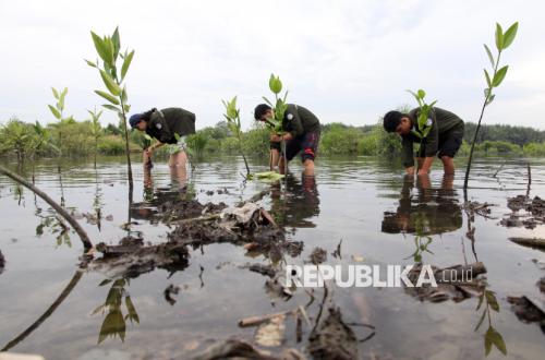
The Provincial Government of North Sumatra has officially commenced a strategic move to strengthen coastal ecosystem protection through a Kickoff Meeting for the Drafting of the Provincial Mangrove Ecosystem Protection and Management Plan (RPPEM) held at Hotel Polonia, Medan. This activity marks a new chapter in mangrove governance in North Sumatra by prioritising a landscape-based approach or Mangrove Landscape Unit (KLM), replacing the previous management pattern fragmented by administrative boundaries.
Based on the Decree of the Minister of Environment/Head of the Environmental Control Agency Number 3438 of 2025, Indonesia possesses mangrove areas reaching 3.45 million hectares. Of this total, North Sumatra has 62,375 hectares of mangroves, making it one of the important regions in the national effort to protect and manage mangrove ecosystems.
The urgency of drafting the Provincial RPPEM in North Sumatra is inseparable from the various pressures faced by the mangrove ecosystem. Despite having approximately 62,375 hectares of mangroves, the condition of this area faces serious threats due to land conversion.
Head of the North Sumatra Environment and Forestry Service (DLHK) and Chair of the Regional Mangrove Working Group (KKMD), Heri Wahyudi Marpaung, assessed that the RPPEM must be able to answer land-use conflict issues while improving the welfare of communities dependent on the mangrove ecosystem. “We are not only protecting the ecosystem, but also how to present economic value that can be felt by all community management groups in North Sumatra. The challenge is to make social forestry mangroves have real economic value, for example through access to business capital or MSME development,” he said.
Heri also emphasised that beyond the quantity, it is important to increase supervision and evaluation after planting. According to him, this can improve the quality of long-term mangrove ecosystem rehabilitation success.
The drafting of the North Sumatra Provincial RPPEM is also carried out to strengthen data synchronisation between agencies to avoid overlapping permits and area utilisation. The use of the 2025 National Mangrove Map as a common reference is expected to create more transparent governance and close loopholes for illegal practices in coastal areas.
Expert for the National RPPEM Drafting Team, Onrizal, explained that one important aspect in drafting the RPPEM is the application of the Mangrove Landscape Unit (KLM) concept. Unlike previous approaches that were often fragmented by district or city boundaries, KLM views the mangrove ecosystem as a single unit influenced by the interconnection of land and sea areas, including the dynamics of watersheds (DAS).
In North Sumatra, seven indicative KLMs have been identified through mapping, namely Muara Lhokseumawe, Muara Hilir Besitang, Semenanjung Asahan Barumun, Pesisir Natal Tapanuli, Laguna Nias Selatan, Laguna Nias Tano, and Semenanjung Dumai. Five of these are entirely within the province, while two are cross-provincial landscapes bordering Aceh and Riau. Through this approach, various upstream activities, such as pollution and land conversion, can be analysed for their impact on the sustainability of downstream mangrove ecosystems.