
M7.7 Earthquake Strikes NTT, Triggers Tsunami Warning and Evacuations
Panic gripped residents of Mbay, Nagekeo Regency, East Nusa Tenggara, on Saturday morning (15/8/2026), after a powerful earthquake shook the region.
The tremor sent residents rushing out of their homes. Some chose to carry out independent evacuation to higher ground, following a potential tsunami warning.
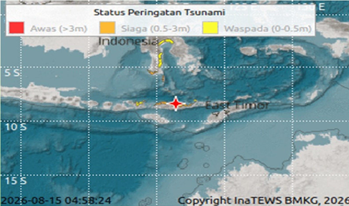
According to official information from the Meteorology, Climatology and Geophysics Agency (BMKG), the initial earthquake was recorded at magnitude 7.0, occurring on Saturday, 15 August 2026 at around 04:58 WIB, with the epicentre located approximately 38 kilometres northeast of Mbay, Nagekeo Regency, at a depth of around 10 kilometres. BMKG stated that the earthquake had the potential to trigger a tsunami.
In subsequent developments, BMKG also updated the earthquake information to magnitude 7.7, with the epicentre around 30 kilometres northeast of Mbay-Nagekeo and a depth of 15 kilometres. BMKG then issued an early tsunami warning for a number of areas.
Adi Liko, a resident of Marapokot, Mbay, said the earthquake tremors caused residents to panic. In fact, his house was reported to have suffered severe damage and was destroyed.
Adi and his family members then chose to leave their home and move towards the Aegela area, which is on higher ground.
“My house was destroyed. I and my family chose to flee to Aegela because we were afraid of a tsunami,” Adi told MediaIndonesia on Saturday morning.
A number of residents living in coastal areas chose to move away from the beach and head to places considered safer. This condition was triggered by changes in sea level observed along the coast.
Mbay residents reported that sea water around Marapokot Port began to recede quite far after the earthquake. The phenomenon of sea water suddenly receding is a serious concern because a shallow earthquake with great strength in a marine area can potentially trigger a tsunami. BMKG itself issued an early tsunami warning following the earthquake.
The impact of the tremor was not only felt by Mbay residents. The earthquake vibrations were reported to be felt in a number of areas on Flores Island and even as far as Lombok.
In the Flores region, initial reports from the public also mentioned building damage in several areas.
Residents reported that several buildings and infrastructure suffered damage, ranging from Maumere, Sikka Regency; Mbay, Nagekeo Regency; Bajawa, Ngada Regency; the Manggarai area; to Labuan Bajo, West Manggarai Regency.
However, reports regarding the number of damaged houses and buildings as well as casualties are still being collected. The damage data needs to be verified by the local government, BPBD, security forces, and assessment teams in the field.
The reported receding sea water conditions in coastal areas were one of the reasons residents chose to evacuate immediately. In addition to around Mbay, residents also reported receding sea water conditions in the Aimere Port area, Ngada Regency.
In situations like this, residents in coastal areas are urged not to approach the beach to observe sea water conditions.
The main priority is to move to higher ground and follow official directions from the government and disaster management officers.
BMKG previously recorded that a number of areas in NTT were included in the potential tsunami warning due to the earthquake, including northern Manggarai, Ngada, West Manggarai, Ende, and Sikka.
As of Saturday morning, conditions in several affected areas were still in the process of data collection. The local government together with BPBD and related officials need to immediately conduct an assessment to determine the number of victims, damage to houses, public facilities, electricity networks, roads, ports, and other vital infrastructure.
Information regarding residents’ houses destroyed in Marapokot, Mbay, is one of the initial reports of damage caused by the earthquake.
Data collection is also important to ensure whether reports of building damage in Maumere, Mbay, Bajawa, Manggarai to Labuan Bajo are truly related to the main earthquake and the series of earthquakes that occurred that morning.
In addition to building damage, attention also needs to be directed to the possibility of landslides, road access disruptions, damage to communication and electricity networks, as well as the condition of ports and coastal areas.
Amid the panic, the public is asked not to spread unverified information. Residents in coastal areas should remain away from the beach while the early warning is still in effect and follow official information from BMKG and the local government.
The earthquake demonstrates the magnitude of the disaster threat in the Flores and NTT regions. With the epicentre relatively close to Mbay and a shallow depth, the tremors were felt strongly in various areas.
The situation on the ground remains dynamic. The number of casualties, building damage, and impact on infrastructure cannot yet be fully confirmed and is still awaiting official data collection results.