List of 39 RTs and 13 Roads Flooded in Jakarta This Morning
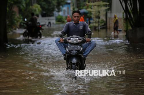
Jakarta – The Jakarta Provincial Disaster Management Agency (BPBD) reports an increase in floodwater levels at several points following heavy rainfall that has drenched the capital since Sunday (8 March 2026) early morning. According to the latest data, 39 Rukun Tetangga (RT) and 13 roads have been recorded as flooded with varying water heights.
The rise in flood points is the impact of extreme rainfall and overflows from several river branches. ‘Flooding occurred due to heavy rain in Jakarta and its surroundings from Saturday to Sunday,’ said Mohamad Yohan, head of the BPBD Jakarta’s Disaster Data and Information Centre, in Jakarta on Sunday (8 March 2026).
BPBD DKI Jakarta has carried out various measures to mitigate the impact of floods at affected locations. He said the latest data show floods encompassed 39 RT and 13 roads located in West Jakarta and South Jakarta.
Yohan said water heights ranged from 20 centimetres (cm) to a maximum of 1.5 metres. ‘In Pela Mampang sub-district there is one RT submerged up to 1.5 metres,’ he added.
Here are the 39 RTs and 13 flooded roads as of early Sunday:
In West Jakarta there are 19 RTs, consisting of:
Kedaung Kali Angke sub-district: 4 RT, height 60-70 cm
Kedoya Selatan sub-district: 4 RT, height 30 cm
Kedoya Utara sub-district: 4 RT, height 20 cm
Sukabumi Selatan sub-district: 2 RT, height 120 cm
Joglo sub-district: 1 RT, height 65 cm
Kembangan Selatan sub-district: 2 RT, height 50 cm
Kembangan Utara sub-district: 2 RT, height 60 cm
In South Jakarta there are 20 RT comprising:
Cilandak Barat sub-district: 1 RT, height 120 cm
Cipete Utara sub-district: 3 RT, height 100 cm
Petogogan sub-district: 12 RT, height 20 cm
Pela Mampang sub-district: 1 RT, height 150 cm
Duren Tiga sub-district: 1 RT, height 50 cm
Cilandak Timur sub-district: 2 RT, height 120 cm