
List of 10 Areas Affected by Today's NTT Earthquake
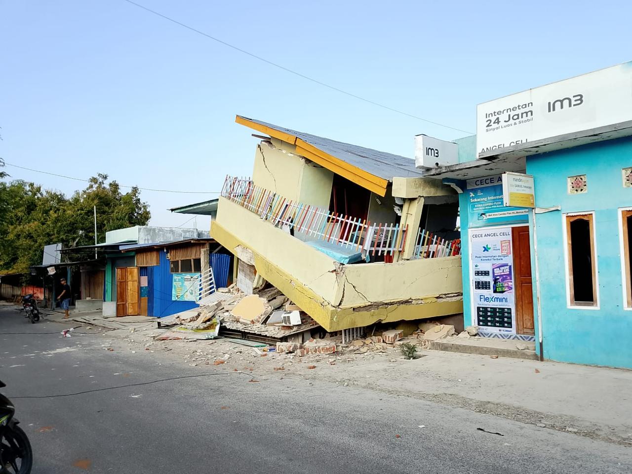
East Nusa Tenggara (NTT) Province is geographically situated in an active seismic zone, making it vulnerable to tectonic activity. Today, earthquake activity was again reported to have shaken the region, prompting alertness among local residents. Based on collected data, the tremors were felt at various points with varying intensity.
It is important to understand that NTT lies at the meeting point of major tectonic plates and has a number of active faults both on the seabed and on land. This causes the frequency of earthquakes in this region to be quite high compared with several other regions in Indonesia. The following is a review of the affected areas as well as steps that must be taken when facing an emergency situation.
Based on initial reports and monitoring of seismic activity, the following are 10 areas in East Nusa Tenggara that felt the impact of today’s earthquake tremors. It should be noted that the level of shaking is measured using the MMI (Modified Mercalli Intensity) scale to describe what is felt by people and the physical impact on buildings.
When an earthquake occurs, BMKG usually issues information regarding the MMI scale. The following is a brief guide to understanding the meaning of the scale.
Given that NTT is an earthquake-prone region, education regarding disaster mitigation is crucial. The following is a practical guide for the public.
Geologically, the NTT region lies on the Flores Back Arc Thrust path. In addition, in the southern part there is a subduction zone where the Indo-Australian plate subducts beneath the Eurasian plate. It is this interaction between plates that periodically releases energy in the form of earthquakes.
Public preparedness and earthquake-resistant building construction are key to minimising the risk of casualties in this region. Regional governments continue to be urged to strengthen early warning systems at vulnerable points.
Remain vigilant and ensure that you obtain information from credible sources to avoid hoaxes that often circulate after a disaster.
A total of 281 personnel from the TNI, Polri, KSOP, BPBD, PMI, regional government, and other SAR potential elements were involved in the operation.
The Meteorology, Climatology, and Geophysics Agency (BMKG) recorded 235 aftershock activities as of 14.00 WIB.
The House of Representatives (DPR) urged the government to accelerate the distribution of aid to isolated areas affected by the M 7.7 NTT earthquake. Prioritise the safety of residents and evacuation.
BNPB has mobilised a number of emergency aid items at the earliest opportunity. The aid was mobilised from BNPB logistics warehouses in East Flores.
The central government held a coordination meeting to ensure that emergency handling of the M7.7 earthquake in East Nusa Tenggara (NTT) runs optimally.
Source: jawawa.id (https://jawawa.id/newsitem/list-of-10-areas-affected-by-todays-ntt-earthquake-1786805427)
Originally published by Media Indonesia (https://mediaindonesia.com/nusantara/922229/daftar-10-wilayah-terdampak-gempa-ntt-hari-ini), translated from Indonesian