
Latest Update on Forest and Land Fires Across Indonesia
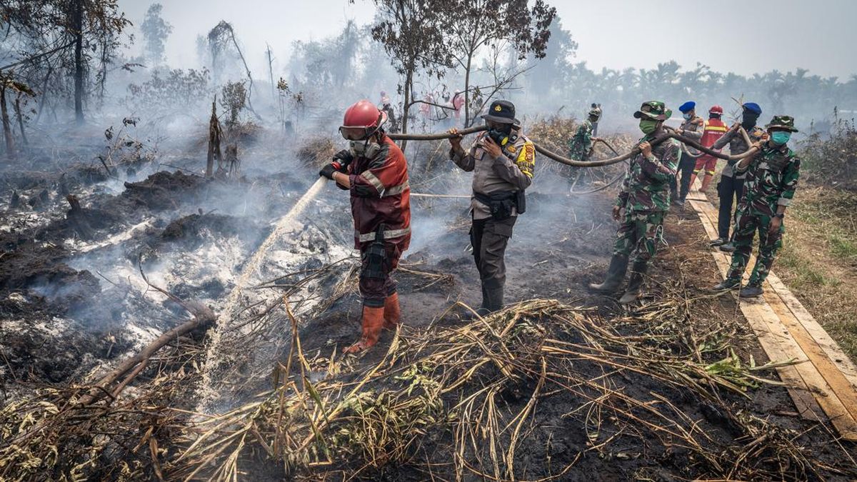
Forest and land fires (Karhutla) have continued to affect several regions in Indonesia over recent days. The fires in Kalimantan have even triggered smoke haze reaching Sarawak, Malaysia, where authorities closed schools to protect students.
In West Kalimantan, authorities successfully handled 13 hectares affected by forest and land fires using various methods including water bombing and weather modification operations. Meanwhile, ground operations managed to address 104.8 hectares of land. The Ministry of Forestry has imposed sanctions on four companies related to these fires: PT WEL, PT FI, PT MPK, and PT WSP.
In East Kalimantan, according to a recapitulation by the provincial disaster mitigation agency (BPBD), 430 forest and land fire incidents were recorded up to last week, with an affected area reaching 1,260.92 hectares. Most of the burned land belongs to companies. Of the total affected area, 1,197.32 hectares were land, 32.84 hectares were forest, and 30.71 hectares were plantations. Kutai Kartanegara was the area with the largest burned area, followed by Kutai with 71 incidents, Paser with 105 incidents, Samarinda with 69 incidents, and Berau with 38 incidents. The Ministry of Forestry has imposed sanctions on PT PSR in East Kalimantan.
In Central Kalimantan, there were 25 hotspots. Authorities carried out water bombing and weather modification operations in affected areas. Ground operations successfully handled 55.63 hectares of burned land up to Sunday. The Ministry of Forestry has imposed sanctions on PT NES in Central Kalimantan.
In South Kalimantan, officers successfully handled around 13 hectares of burned land through air operations and 40.9 hectares through ground operations.
In Jambi, monitoring identified 14 hotspots. Cumulative water bombing operations up to 23 August handled around 226.9 hectares of land. Ground operations were still ongoing in several locations with statuses of extinguished, being extinguished, and cooling.
In Batam, Riau Islands Province, a fire occurred on Saturday (22/8) on Jalan Trans Barelang, Tembesi Village, Sagulung District. The burned land was estimated at 35 hectares. The Riau Islands BPBD and a joint team deployed several fire engines for ground suppression. The fire was reported extinguished on Sunday (23/8). The Meteorology, Climatology and Geophysics Agency (BMKG) stated that air quality in Pekanbaru was in the hazardous category.
Similar conditions were reported in Samosir Regency, North Sumatra. A hotspot was detected on Saturday (22/8) at around 18.00 WIB at Bukit Sitalmak Talmak, Dolok Raja Village, Harian District. The burned area was estimated at five hectares. The BPBD, joint team, village government, and community carried out ground suppression. The fire was reported extinguished on Sunday.
Meanwhile, a larger-scale forest and land fire occurred in Nabire Regency, Central Papua. Fires were reported from 18 July to 23 August 2026 across seven districts: Teluk Kimi, Nabire Kota, Nabire Barat, Wanggar, Nabire, Makimi, and Yaur. The fires were triggered by hot weather, strong winds, and abundant dry shrubs and weeds. According to data collected by the Nabire BPBD, around 396.13 hectares of land burned and four households were affected. As of Sunday, some hotspots could not be extinguished because fire engines could not reach them, according to an official release from the National Disaster Management Agency (BNPB). In response, the local government identified the need for further support including water bombing and additional fire engines to handle areas difficult to reach by ground operations.