
Latest Google Maps satellite imagery reveals extent of destruction in Gaza
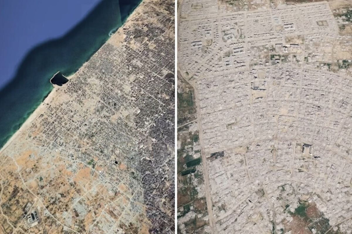
Istanbul (ANTARA) - Satellite imagery updates on the Google Maps application on Monday have revealed the vast extent of infrastructure destruction in the Gaza Strip resulting from years of Israeli aggression.
The satellite images show residential areas and housing blocks disappearing entirely, alongside devastated urban zones. The latest images demonstrate a highly dramatic transformation of the Gaza Strip’s urban landscape, where former hubs of settlement and community activity have become empty, uninhabited ruins.
This imagery clearly displaying the destruction in Gaza allows the public to compare the situation before and after the Israeli aggression and to see the severity of the damage in affected areas.
The satellite imagery update comes amidst ongoing Israeli attacks that threaten the lives of Palestinians in Gaza, despite a ceasefire that has been in effect since 10 October 2025. Since the ceasefire, dozens of buildings in Gaza attacked by Israeli forces have collapsed onto their occupants. Meanwhile, local residents are experiencing an acute housing crisis due to restrictions on the logistics of temporary housing.
The threats are not limited to collapsed buildings, as Israeli attacks have caused thousands of structures to suffer severe damage or cracking. Exposure to rain, wind, and bad weather increases the risk of these damaged buildings collapsing.
According to findings from the United Nations (UN) special rapporteur on the right to adequate housing last February, more than 200,000 tons of explosives have been dropped on the Gaza Strip over a two-year period.
Satellite monitoring by the UNOSAT UN Satellite Centre as of 16 June 2026 also shows that 201,290 buildings, equivalent to 82 per cent of all buildings in the Gaza Strip, have been damaged by the war. This figure includes 134,422 destroyed buildings, 13,848 severely damaged buildings, 28,096 moderately damaged buildings, and 24,924 other buildings suspected of being damaged.
Beyond these figures, approximately 328,627 Gaza residential units have also been recorded as damaged. Since the Israeli aggression and genocide in the Gaza Strip began on 7 October 2023, more than 74,000 Palestinians in Gaza have been killed and over 175,000 others injured. It is also noted that 90 per cent of all buildings in the territory have been destroyed or damaged.
Source: jawawa.id (https://jawawa.id/newsitem/latest-google-maps-satellite-imagery-reveals-extent-of-destruction-in-gaza-1790597021)
Originally published by Antara (Indonesian) (https://www.antaranews.com/berita/5761880/citra-satelit-terbaru-google-maps-ungkap-luasnya-kehancuran-di-gaza), translated from Indonesian