
Land Governance Key to Preventing Forest and Land Fires
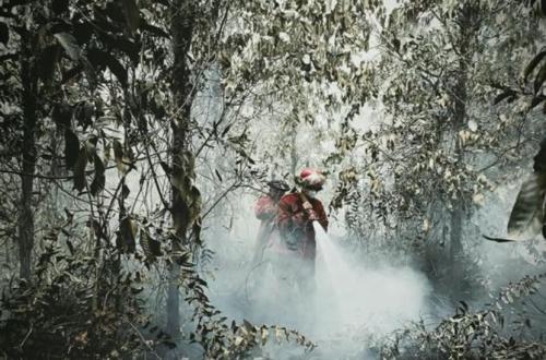
The Indonesian Forest Entrepreneurs Association (APHI) believes that improving land governance is a key factor in preventing recurring forest and land fires (karhutla) in Indonesia. Socio-economic issues, unclear land ownership, and the use of fire for land clearing must be addressed comprehensively so that prevention does not rely solely on enforcement after fires have occurred.
APHI General Chairman Soewarso stated that forest fires are a consequence of fundamental issues at the ground level. According to him, fire management needs to target the root causes that lead communities to continue using fire as a method for land clearing.
“Forest fires are the effect, not the primary cause. The real root problems lie in socio-economic aspects, such as the use of fire for land clearing because it is considered the cheapest and fastest method, as well as traditional pest control. Additionally, many lands have ‘open access’ status or are controlled without spatial planning certainty, making fire triggers difficult to control,” Soewance explained in Jakarta.
He explained that the lack of spatial planning and land ownership clarity makes controlling fire sources increasingly difficult. This situation requires a preventative approach involving the government, business actors, and communities living around fire-prone areas.
To increase vigilance against the threat of forest fires within APHI member areas, Soewarso has issued a circular to all members. APHI also invites fire experts to conduct socialisation and discussions regarding the prevention and management of forest fires.
Forestry expert Petrus Gunarso reinforced the importance of improving land governance through spatial data analysis, combining data from the Forest and Land Fire Information System (Sipongi), palm oil cover, and forest area maps. The analysis shows that most hotspots are located outside formally managed palm oil plantations.
Petrus revealed that 84 per cent of hotspots were detected in non-managed or open-access lands, including 15 per cent of conversion forests, 10 per cent of protected forests, and other open areas. The remaining 16 per cent of hotspots are located within formally managed plantation areas.
According to him, this distribution demonstrates the importance of strengthening land management outside company concession areas. Certainty of land rights and clear spatial planning can help reduce the space for uncontrollable fires to occur.
Petrus compared this condition to Sarawak, Malaysia, which experiences relatively few large-scale fire disasters. He linked this to clear property rights and the firm resolution of spatial planning divisions.
Data from the Ministry of Forestry via Sipongi recorded 28,692 hotspots throughout 1–30 September 2026. Central Kalimantan recorded the highest distribution with 10,896 points, followed by West Kalimantan with 3,969 points, and South Sumatra with 3,506 points.
The Director of Plantation Protection at the Ministry of Agriculture, Ir. Hendratmojo Bagus Hudoro, stated that hotspots are indicators of high temperatures that require direct field verification. Although not all indicate actual fire incidents, the high distribution of hotspots remains a warning for the government and businesses to increase vigilance.
“Hotspots are indicators of high temperatures that need factual ground checks; not all necessarily represent fire incidents. However, full vigilance is maintained considering that plantation commodities are agronomically located on dry land and are at risk when entering the dry season phase,” said Bagus.
The Ministry of Agriculture has implemented several mitigation steps, including establishing 251 hectares of demonstration plots for Zero Burning Land Clearing (PLTB), forming Fire-Aware Farmer Groups in six provinces within the red zones, and requiring over 2,000 plantation business permit holders to meet fire prevention standard requirements.
From the business perspective, the Executive Director of the Indonesian Palm Oil Association (GAPKI), Mukti Sardjono, stated that all 751 GAPKI member companies have met the qualifications for disaster management facilities and infrastructure. GAPKI is also collaborating with the Ministry of Forestry, the Ministry of Environment, APHI, and local government authorities to anticipate fires in the field.
“To date, there have been no reports of fire points entering the concession areas of GAPKI members. We are tightening internal supervision through periodic written advisories and conducting operational cooperation with the Ministry of Forestry and APHI in the field. Fire knows no administrative boundaries, so prevention based on the villages surrounding concessions is our main focus,” said Mukti.
Collaboration between the government, business actors, and communities around fire-prone areas must be strengthened so that prevention efforts reach areas outside company concessions. Improving land governance, ensuring land ownership, and controlling the use of fire are vital components in reducing the risk of recurring forest and land fires.