
Lampung-1 Satellite Launched, Fruit of Indonesia-China Cooperation
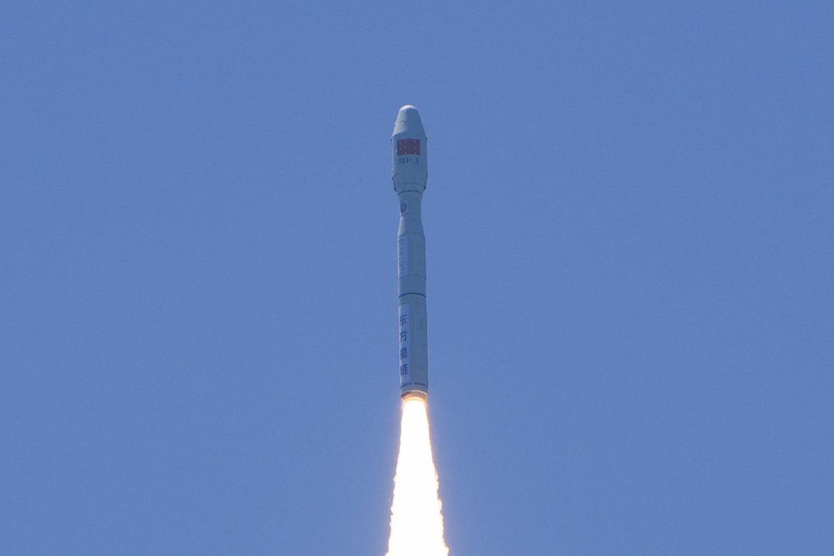
Chinese commercial space company STAR.VISION successfully launched the Oriental Smart Eye (OSE) Hyperspectral-01 and Hyperspectral-02 satellites into their designated orbits on Wednesday morning (5/8) using a Jielong-3 Y12 carrier rocket from waters off the coast of Haiyang City, Shandong Province, eastern China, completing the launch mission.
The OSE Hyperspectral-01 satellite was jointly developed by STAR.VISION, Wuhan University, and several related institutions, including the government of Lampung Province, Indonesia. The satellite, named “Lampung-1” by the Indonesian side, carries a mission of Indonesia-China cooperation in the fields of remote sensing applications, artificial intelligence (AI), and space capacity development.
According to STAR.VISION, Lampung-1 weighs 300 kg and carries 22 precisely calibrated spectral channels, covering a wavelength range of 400-1,650 nanometres. The satellite has a spatial resolution of up to 5 metres and a single-satellite imaging swath width of 300 km. The network of the two satellites is capable of achieving a global revisit cycle of 5 days.
One of the satellite’s key advantages is its onboard computing capacity of 400 TOPS, which enables artificial intelligence inference in space. The satellite is able to process and interpret imagery while in orbit, including identifying crops and assessing disasters, and only transmits the inference results back to Earth, significantly improving information transmission efficiency.
For Indonesia, hyperspectral AI satellites hold great application potential. As a large archipelagic nation with vast maritime areas and rich terrestrial ecological resources, Indonesia has broad needs in ecological and environmental protection, agricultural development, mineral resource management, and maritime monitoring. By analysing the spectral response characteristics of various types of materials, hyperspectral satellites can identify the composition and changes of land surfaces, water bodies, and the atmosphere, thereby providing technological support for agricultural production, ecological protection, resource surveys, and environmental governance in Indonesia.
“The spectral design of Lampung-1 fully takes into account the geographical characteristics and industrial structure of Lampung Province, making it highly suitable for agricultural monitoring, maritime resource management, and natural disaster response,” said a STAR.VISION representative.
The representative said that the Lampung-1 project prioritises the joint development of application scenarios, ground systems, and talent teams with local government and research institutions.
“During the research and development process, Indonesian experts made important contributions, marking a new exploration in strengthening joint research and shared development between China’s space sector and Global South countries,” the representative added.
China and Indonesia have long maintained cooperation in the space sector. From communication satellite launch services and ground facility cooperation to remote sensing data applications and broader space services, both sides continue to expand the scope of cooperation.
Launched at the China-ASEAN Expo 2025, the China-ASEAN AI Satellite Constellation adheres to the principle of “one country, one satellite, joint development and shared benefits”.
The initiative aims to build shared cross-border spatio-temporal intelligent infrastructure to meet the needs of ASEAN countries in agricultural production, ecological and environmental protection, maritime governance, disaster warning, and space information services.
In recent years, as Indonesia’s demand for ecological environment monitoring, agriculture, and mineral resources has increased, bilateral space cooperation has evolved from conventional communication satellites to remote sensing satellites, space information services, and artificial intelligence applications.
STAR.VISION’s cooperation with various institutions in Indonesia is one example of the increasingly close space partnership between Indonesia and China.
In May 2025, the Lampung provincial government signed a memorandum of understanding (MoU) on space cooperation with STAR.VISION, Oriental Maritime Space Port, and other partners in China to advance the development of Lampung-1, Indonesia’s first hyperspectral AI satellite.
Subsequently, STAR.VISION cooperated with Indonesia’s National Research and Innovation Agency (BRIN) to enhance remote sensing data applications, opened satellite data services for users in Indonesia through the OSE Early Bird programme, and handed over the TerraVista satellite remote sensing application platform to BRIN, further strengthening local space information application capabilities.
Lampung-1 also represents an important milestone in the development of the China-ASEAN AI Satellite Constellation. As the first satellite in the constellation, its successful entry into orbit demonstrates progress in China-ASEAN space cooperation, evolving from project-based collaboration to constellation-based deployment and regional-level utilisation.
As follow-on satellites and ground application systems are developed, the constellation is expected to deepen cooperation between China and ASEAN in satellite development, data services, AI applications, and industrial coordination, providing new technological impetus for regional digital economic development.
Source: jawawa.id (https://jawawa.id/newsitem/lampung-1-satellite-launched-fruit-of-indonesia-china-cooperation-1785948745)
Originally published by Antara (Indonesian) (https://www.antaranews.com/berita/5681671/satelit-lampung-1-diluncurkan-buah-kerja-sama-indonesia-china), translated from Indonesian