
Lake America and the Limits of Executive Authority
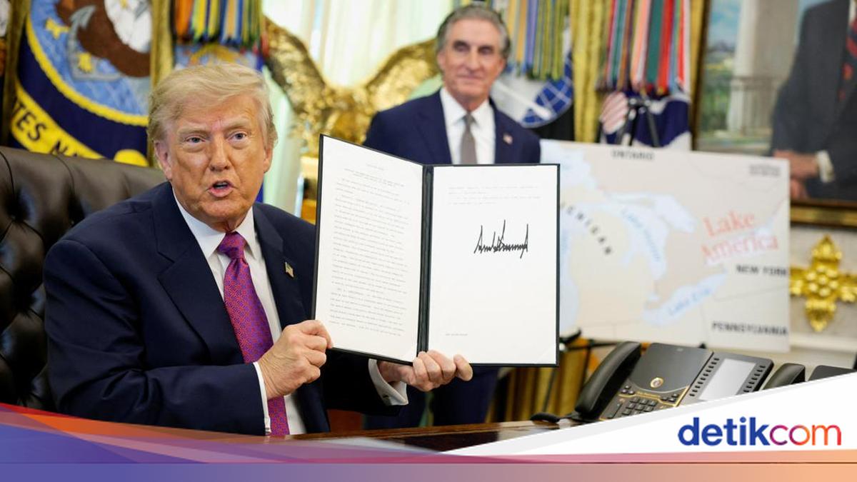
My morning coffee was not yet half-finished when my timeline was flooded with a news item that, quite frankly, made me pause from my data review. A lake on the border between the United States and Canada, known to the world for centuries by its name, suddenly changed its face on official state documents. This was not achieved through toponymic studies or consultations with local residents, but through the stroke of a president’s pen in the Oval Office.
On 27 August 2026, President Donald Trump signed an executive order renaming Lake Ontario to ‘Lake America’. The order directs the United States Department of the Interior—the department responsible for federal lands and natural resources—to coordinate with the Board on Geographic Names and update the nation’s geographic name database within 30 days. Canadian Prime Minister Mark Carney did not take long to respond.
Via social media, he noted that the name Ontario originates from the Wendat word, ‘Ontari’io’, which means ‘beautiful lake, large lake’. It is over 400 years old, far older than both the Canadian Confederation and the United States Declaration of Independence. For Canadians, he stated, the name will remain: in the past, now, and forever.
I have intentionally avoided adding unverified rumours from social media. The more fundamental issue, which I believe is more worthy of reflection for readers, is the recurring question: To what extent does a president’s signature actually hold the power to change a name used across borders for hundreds of years?
That question has two layers of answers that are often confused in public discourse. The UN Convention on the Law of the Sea (UNCLOS) regulates sovereignty and jurisdiction, from territorial seas to exclusive economic zones and the high seas, answering who has rights to what. The matter of names, however, lies in a different realm: the International Hydrographic Organization (IHO) publishes the ‘Limits of Oceans and Seas’ as a reference for the names and boundaries of the world’s oceans and seas, while the United Nations Group of Experts on Geographical Names (UNGEGN) encourages each country to establish its own national naming authority and register it in a gazetteer.
Two boundaries became immediately apparent as Trump’s signature ink dried, and both are worth examining. The first boundary is legal. Lake Ontario is not a body of water entirely under US control; it is managed jointly with Canada through the Boundary Waters Treaty, an early 20th-century agreement designed to prevent and resolve disputes over shared waters. Therefore, Trump’s executive order only binds official documents and maps of the US federal government, relying on domestic law regarding the uniformity of geographic nomenclature. Legally, Canada remains untouched by the order.
The second boundary is technological, which I find most fascinating for those working in geospatial fields. Once the United States Geological Survey updates its official name database, Google announced it would follow the change, but only for users within the United States. Users in Canada will continue to see ‘Lake Ontario’, while users outside both countries will likely see both names simultaneously. Google stated that its policy follows the official government sources of each respective country. In the digital age, sovereignty over a name is no longer just about who has the legal right to establish it, but also about which platform decides to display it to whom. The maps in our palms now have new gatekeepers that did not exist before: not intergovernmental agencies, but private technology companies.
At this point, I find it useful to look closer to home. I have previously written about the Ambalat Block and the Celebes Sea: how two nations can view the same expanse of sea with two different names and two different historical memories, without either being forced to surrender to the other’s name. Indonesia’s experience in naming the North Natuna Sea is similar. The principle is consistent: names can coexist according to the functions and interests of each party, without necessitating the negation of the other.
Indonesia already possesses a sufficiently structured framework for this matter. Since the issuance of Government Regulation Number 2 of 2021 regarding the Implementation of Toponymy, the Geospatial Information Agency has been designated as the national naming authority, with the Gazetteer of the Republic of Indonesia serving as the official list of standardised geographic names accessible to the public. The implementation of these rules is further strengthened by the Geospatial Information Agency Regulation Number 6 of 2023. The difference with the ‘Lake America’ case is precisely what I wish to emphasise: a single presidential signature, applied unilaterally to its own country’s federal maps, is clearly different in scale from a mechanism involving field verification and multi-party consultation.