
Kalimantan Surrounded by 1,842 Hotspots, Central Kalimantan Contributes the Most
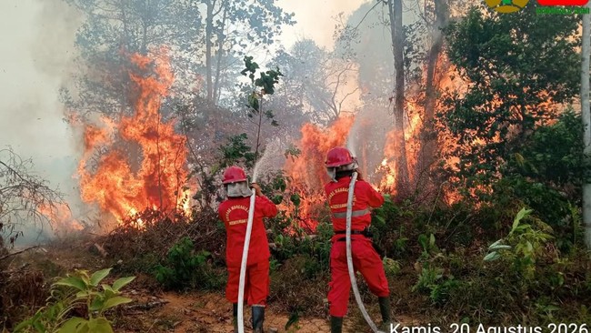
Central Kalimantan has become the region with the highest number of hotspots in Kalimantan. A total of 976 hotspots were detected in the province through satellite monitoring on 21 August 2026.
Based on data from the Forest and Land Fire Control Information System (SiPongi), NASA-NOAA 20 satellite monitoring on 21 August 2026 at 14.14 WIB recorded 1,842 hotspots across five provinces in Kalimantan.
Of that figure, Central Kalimantan contributed more than half of the detected hotspots, namely 976 points. Of these, 968 points had a medium confidence level, while eight points had a high confidence level.
West Kalimantan was the province with the second-highest number of hotspots, at 489 points. The figure consisted of 487 points with medium confidence and two points with high confidence.
Furthermore, East Kalimantan recorded 237 hotspots, followed by South Kalimantan with 125 points and North Kalimantan with 15 points. All hotspots in these three provinces were monitored with a medium confidence level.
The high number of hotspots has drawn attention amid the strengthening of forest and land fire (karhutla) handling by the National Disaster Management Agency (BNPB).
BNPB is currently strengthening integrated karhutla operations in six priority provinces, namely Riau, Jambi, South Sumatra, South Kalimantan, Central Kalimantan, and West Kalimantan.
Handling is carried out through the deployment of ground and air task forces under the coordination of command posts, involving local governments and various relevant stakeholders.
For air operations, BNPB has deployed 39 air assets in the six provinces. The fleet consists of patrol helicopters, aircraft supporting weather modification operations (OMC), and water bombing helicopters.
In Central Kalimantan itself, the air task force has been reinforced with one patrol helicopter unit, one OMC unit, and four water bombing helicopter units.
The deployment of air assets is intended to strengthen aerial monitoring, support hotspot detection, assist in fire suppression, and accelerate intervention in areas requiring air support.
Air patrols are conducted to monitor developments on the ground. Meanwhile, water bombing is used to assist in extinguishing fires in locations that are difficult to reach by land or require additional support from the air.
As for OMC, it is carried out by considering cloud growth conditions and handling needs in priority areas.
BNPB is also encouraging local governments to improve preparedness and establish alert or emergency response status in accordance with the development of karhutla threats in their respective regions.
Hotspot data serves as one reference in monitoring the development of potential karhutla and determining handling needs in the field. However, hotspots detected by satellite do not necessarily indicate confirmed forest and land fires.
The public is also urged to increase vigilance during the karhutla-prone period and to immediately report any fire spots or fire incidents to officials or local governments.
Source: jawawa.id (https://jawawa.id/newsitem/kalimantan-surrounded-by-1-842-hotspots-central-kalimantan-contributes-the-most-1787367053)
Originally published by CNBC Indonesia (https://www.cnbcindonesia.com/news/20260822071627-4-761446/kalimantan-dikepung-1842-titik-panas-kalteng-sumbang-terbanyak), translated from Indonesian