
Indonesia's Megathrust Zone Map Updated, Japanese Expert Highlights Quake Risk
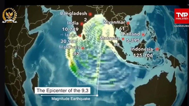
The risk of large-scale earthquakes in Indonesia has returned to the centre of public and expert attention following the launch of an updated 2024 seismic hazard map, which now records 14 megathrust zones. The latest map indicates a significantly higher potential for danger compared to the 2017 version, with hazard contours appearing increasingly dense across several regions of the country. The increase in identified megathrust zones has also drawn the attention of Japanese experts. Professor Kosuke Heki from Hokkaido University noted that Indonesia’s geological characteristics bear similarities to the Nankai Trough, one of the world’s most active megathrust areas. “We understand that magnitude 8 earthquakes in Japan occur at intervals of about 50 to 100 years. This was our classical view before the great earthquake,” Heki stated during a visit to the National Research and Innovation Agency (BRIN) in late December 2025. Heki explained that while predicting the exact timing of a major earthquake remains difficult, long-term monitoring of crustal deformation is crucial for disaster mitigation. He stressed the importance of the Global Navigation Satellite System (GNSS) and seafloor geodetic measurements to read the accumulation of strain in subduction zones. “We see that there is a coupling between seismic plates that are locked almost along the entire trench axis. Even at the very shallow plate boundary, strain continues to accumulate for the next earthquake,” he explained. Heki also highlighted the phenomenon of slow slip events, which often appear before major earthquakes. Although these movements are very slow, they are considered potential early indicators. “This phenomenon has been observed repeatedly in the Nankai Trough and other areas in Japan. One of these slow slip events could potentially trigger the next great earthquake,” he said. He assessed that Indonesia has a significant opportunity to develop a similar monitoring system, given its many active subduction zones stretching from Sumatra, Java, Bali, and Lombok to Maluku. By strengthening GNSS networks and seafloor monitoring technology, Indonesia could read tectonic stress accumulation with greater precision. “I am currently working on this problem in Indonesia,” Heki added. The updated map records the Aceh-Andaman Megathrust as having the highest potential, with a maximum magnitude of 9.2, while the Java Megathrust could trigger a quake up to magnitude 9.1. Other zones, including Mentawai-Siberut and Enggano, also store potential for magnitude 8.9 earthquakes. The Meteorology, Climatology, and Geophysics Agency (BMKG) previously highlighted that the Sunda Strait and Mentawai-Siberut megathrust zones remain seismic gaps, having not released large amounts of energy for hundreds of years, since the last major events in 1757 and 1797 respectively. BMKG clarified that the term “seismic gap” does not imply an imminent earthquake. “It refers to accumulated energy that has not been released for a long time. It does not mean a major earthquake will happen soon,” the agency stated.