
Indonesia's Food Production Land Shrinking, Here is the Government's Plan
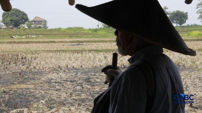
Indonesia is facing serious food security challenges in the future, stemming from the declining quality of food production land and clean water resources.
Law No. 59 of 2024 concerning the National Long-Term Development Plan (RPJP) for 2025-2045 states that the carrying capacity of land and water to support food security is steadily decreasing. “The availability and quality of land for food provision are experiencing a decline. Land availability is under pressure due to the increasing conversion of food production land to other uses,” the Law stated, as reported on Monday (21/9/2026).
It was also noted that the availability and supply of water for food production will decrease, primarily due to competition with other usage sectors. The decline in land and water quality has a tangible impact on the reduced capacity for food provision. Furthermore, the loss of biodiversity is leading to a decrease in the diversity of food sources. “In the future, the potential for food vulnerability in several regions must be closely monitored.”
Eka Chandra Buana, Deputy for Macro Development Planning at the Ministry of National Development Planning/Bappenas, explained that facing the challenges of declining food land quality requires close collaboration between the central and regional governments. The key, according to Eka, is the need for integrated Regional Spatial Plans (RTRW) between the central and regional levels. This is intended to organise agricultural and plantation spaces as Indonesia’s primary food sources.
Additionally, this is necessary to maintain agricultural and plantation lands so they can continue to serve as resources for community food security. “Planning regional spatial layouts is vital. By identifying specific spots, we can regulate which areas are designated for agriculture and which are for tourism and other purposes,” said Eka Chandra during an audience with CNBC Indonesia at Menara Bappenas, Jakarta, on Wednesday (16/9/2026).
Eka cited the impact of spatial mapping for agriculture in Bali as an example. During the COVID-19 pandemic, when Bali’s tourism sector was hit, Eka observed that the economic backbone for the Balinese people was the agricultural sector. This resulted in a shift of human resources from the tourism sector to agriculture. This phenomenon, Eka explained, serves as a lesson for Bali regarding economic sector diversification.
However, Eka noted that planning without supervision is insufficient to prevent the conversion of agricultural land from its social function to other uses. Strict legal compliance and supervision are required to protect food security land. “Therefore, compliance with the RTRW is essential, and it will be a focus; if there is non-compliance, legal consequences will follow,” he stated.