
Indonesia Still Grappling with 793 Wildfire Hotspots, Central Kalimantan Worst Affected
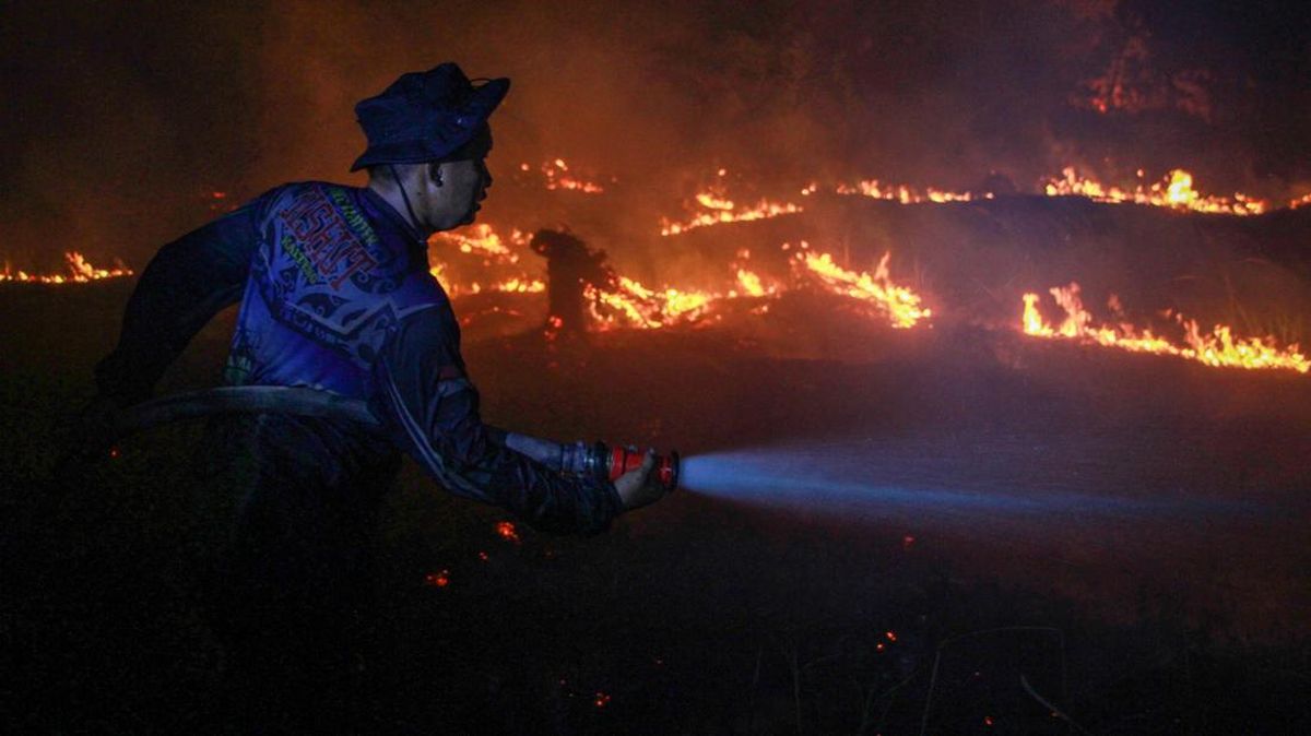
The Forestry Ministry recorded 793 forest and land-fire hotspots nationwide as of 9pm on Saturday (10 October), an increase of 356 from the 437 recorded on Friday (9 October).
According to monitoring by the ministry’s Forest and Land Fire Early Detection and Control Information System (SiPongi), the detected hotspots were classified as high confidence, based on data from NASA’s Terra/Aqua, SNPP and NOAA-20 satellites.
Across the six provinces prioritised for fire control, 288 high-confidence hotspots were recorded in Central Kalimantan, 60 in South Sumatra, 44 in West Kalimantan, 28 in South Kalimantan, one in Jambi and none in Riau.
“In total, the six priority provinces recorded 421 high-confidence hotspots, up from 270 the previous day,” the Forestry Ministry said in a written statement on Sunday (11 October).
The largest increase was concentrated in Central Kalimantan, where the number of hotspots accounted for more than half of the total in the six priority provinces. Monitoring, patrols, ground checks and on-site control operations are therefore being stepped up.
South Sumatra, meanwhile, recorded fewer hotspots than the previous day. However, vigilance must be maintained because weather conditions and dry spells could still contribute to fires.
The Forestry Ministry reiterated that a hotspot is an indication of a surface-temperature anomaly detected by satellite and cannot be directly equated with the number of fires or the area burned.
“A single fire may be detected as several hotspots. Each indication must therefore be verified through direct field inspections to establish the actual situation and determine the necessary response,” it said.
Separately, the National Disaster Mitigation Agency (BNPB) reported forest and land fires in 10 districts in Merauke regency, South Papua province, at 6pm local time on Friday (9 October).
The affected districts were Kurik, Nokenjere, Sota, Tanah Miring, Eli Kobel, Muting, Subur, Ilwayab, Ngguti and Kaptel, said Berton SP Panjaitan, acting head of the BNPB’s Disaster Data, Information and Communication Centre, in a statement on Sunday (11 October).
The fires were reported at Harapan Makmur village, Kondo village, Sota village, Sarmayam Indah village, Bumun village, Set Agung village, Wakai village, Wanam village, Salam Epe village and Ihalik village.
Preliminary data put the area burned at about 63 hectares across nine locations for which details were available. The extent of the fire in Kondo village, Nokenjere district, was still being assessed.
On Saturday (10 October), fires in Harapan Makmur, Sota, Sarmayam Indah and Bumun were reported extinguished, with crews moving into the cooling phase.
The fire in Set Agung was still being tackled, while the response in Wanam and Salam Epe was being handled by companies.
Fires in Kondo village in Nokenjere district, Wakai village in Subur district and Ihalik village in Kaptel district had not yet been brought under control because the sites were remote and difficult to reach.
“These conditions pose challenges to firefighting efforts, so monitoring and coordination with relevant parties must continue. No casualties had been reported as of the time of the report,” Berton said.
Source: jawawa.id (https://jawawa.id/newsitem/indonesia-still-grappling-with-793-wildfire-hotspots-central-kalimantan-worst-affected-1791723057)
Originally published by CNN Indonesia (https://www.cnnindonesia.com/nasional/20261011184520-20-1414181/ri-masih-dikepung-793-titik-api-karhutla-kalimantan-tengah-terparah), translated from Indonesian