
Independence from Disaster Vulnerability
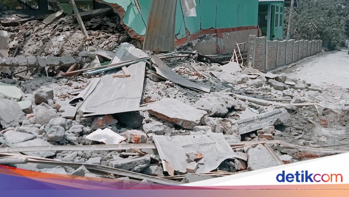
Indonesia has just celebrated 81 years of independence, exactly two days after the earth north of Flores reminded the nation that a certain vulnerability remains unresolved. In the early hours of Saturday, 15 August 2026, at 04.58 WIB, a magnitude 7.7 earthquake shook Flores. The quake originated from the Flores Back-Arc Thrust, a thrust fault on the seabed about 30 kilometres northeast of Nagekeo.
The tremor claimed at least 47 lives according to updated BNPB data two days after the quake, and forced more than 5,000 residents to flee their homes—precisely as the nation was preparing to hoist the flag and hold 17 August competitions.
Whenever a major disaster strikes, public attention almost always turns to speed: how quickly sirens sound, warnings spread, and rescue teams arrive. That narrative is not wrong, merely incomplete. Behind it lies a more fundamental question: to what extent can artificial intelligence—already capable of predicting economic recessions and tomorrow’s weather—be relied upon to free this nation from disaster vulnerability in the Pacific Ring of Fire?
It must be acknowledged that Indonesia’s response this time was far more alert than two decades ago. BMKG issued a tsunami early warning just 2 minutes and 16 seconds after the earthquake occurred, then lifted it about 2.5 hours later once sea levels were no longer a concern. This speed is the result of long learning from two major tragedies: the Aceh tsunami, which prompted the establishment of the Indonesia Tsunami Early Warning System, and the Pangandaran tsunami two years later. Today, the system known as InaTEWS is supported by hundreds of automatic seismograph stations across the country.
However, speed of response is one thing, while the ability to predict is something else entirely. BMKG has repeatedly stressed that science and technology are not yet able to predict precisely and accurately when, where, and how large an earthquake will be. This is not a research failure, but rather a physical characteristic of earthquakes themselves, whose patterns are far more random than the atmospheric movements that govern weather. Hundreds of aftershocks shook Flores within a single day, and such a complex pattern cannot yet be translated into reliable predictions by artificial intelligence technology.
Acknowledging this limitation actually opens space to view AI’s role more clearly. AI can accelerate the dissemination of warnings and reduce the delay from minutes to seconds—as pioneered by the ShakeAlert system on the west coast of the United States and the early warning system of the Japan Meteorological Agency. Mapping of the most vulnerable areas and buildings can also become more precise, so that mitigation budgets can be directed to the most critical points rather than distributed evenly.
In addition, there is room for simulating evacuation routes along tsunami-prone coastlines, because early warnings are only meaningful if residents know where to seek safety. Once a disaster has occurred—such as the damage to five airports and two seaports in East Nusa Tenggara this week—AI-based satellite imagery analysis can map the damage within hours so that aid arrives more quickly.
Evidence of the success of this approach already exists in Australia, our southern neighbour. The country, which grapples with massive bushfires every year, has just tested an artificial intelligence model in Sunshine Coast, Brisbane, and Hobart. The result: the model consistently outperformed the Fire Behaviour Index—the country’s official fire risk assessment system—with an improvement in early detection accuracy of 10 to 30 per cent. The case is different, but what deserves note is the courage to test AI openly against the official system in operation, as well as the willingness to change methods once a more effective one is proven.
There is also a more fundamental issue than technology alone, namely sovereignty. From 1629 to 2018, Indonesia experienced 177 tsunami events according to official BNPB records. Based on the World Risk Index 2025, Indonesia ranks third in the world for disaster risk with a score of 39.80, below the Philippines and India.
With such a long track record, the question is no longer whether the nation is capable of possessing AI technology for disaster mitigation, but whether it will continue to be a passive user of systems built by other countries, or begin building its own artificial intelligence trained on Indonesia’s seismic data and geological characteristics. A nation standing atop the meeting point of the world’s most active tectonic plates should not merely be a market for foreign mitigation technology, but a producer of technology and knowledge about its own natural environment.
The meaning of 81 years of independence perhaps needs to be reflected upon once more. Independence is no longer simply about being free from human colonisation, but about how far we narrow the gap between the moment a disaster strikes and the arrival of help, and between ignorance of the timing of an event and readiness to face the certainty that disaster will come again.
That kind of independence is fought for in seismology research laboratories and in every budget meeting that determines the allocation for research in technology and disaster mitigation. From there it will eventually be seen whether this nation is truly serious about achieving independence from disaster vulnerability, or merely waiting for the next disaster to come and remind us once again.