
How Climate Change is Exacerbating Mountain Landslides in Nepal
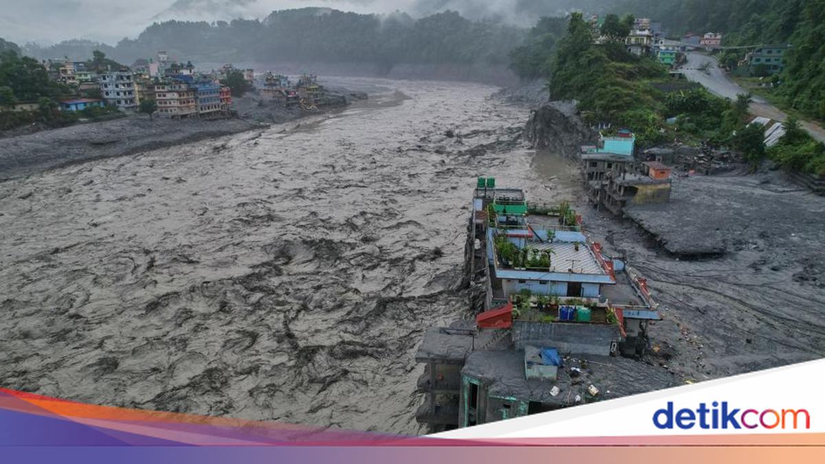
Nearly 1,400 people have died after mountain slopes collapsed and flash floods swept through valleys in Nepal and Tibet, with more than 5,000 people still reported missing.
Initially, the landslides were suspected to have been caused by an earthquake. However, experts now conclude that the disaster resulted from a complex series of factors. Climate change has contributed to creating the conditions that allowed the disaster to occur. Rising temperatures have caused glaciers to shrink, permafrost layers to melt, and meltwater volumes to increase. These conditions rendered the slopes increasingly unstable until they finally collapsed on 26 August 2026.
“This was not caused by a single trigger,” said Walter Immerzeel, a mountain hydrologist at Utrecht University, Netherlands, to journalists during a press conference. “The collapse occurred at an altitude of approximately 5,150 metres (about 16,896 feet), and there were a number of processes occurring simultaneously over years or even decades, not just one,” he stated.
How did this disaster occur?
The flooding began upstream due to a massive rockslide on the northern side of Langtang Lirung. Simultaneously, part of a glacier collapsed, sending approximately 110 million cubic metres of rock and glacial ice down the mountain. This volume is equivalent to 44,000 Olympic-sized swimming pools. A rockslide of this magnitude is a rare event, estimated to occur only once every 1,000 to 10,000 years.
The material fell approximately 1,400 metres from the mountain to the valley floor. In its descent, the debris carried rubble, water, ice, rock, and sediment. The impact released energy equivalent to a magnitude 5.2 earthquake. As it hit the valley, the landslide also tore through buried glacial ice, adding up to 30 million cubic metres of debris and water to the flow.
Within approximately seven minutes, the flood reached the Nepal-China border at Rasuwagadhi, about 20 kilometres downstream. At that time, the flood was moving at an average speed of 170 kilometres per hour. The flood continued downstream, travelling 200 kilometres in less than seven hours.
How could this happen?
Researchers from World Weather Attribution, an international collaboration of scientists studying the role of climate change in extreme weather and disasters, stated that the collapse occurred due to complex conditions exacerbated by climate change. Temperature increases caused by fossil fuels have altered the natural conditions in the Himalayan region over several decades.
Near the landslide site, the glacier edge retreated by only 75 metres between 1964 and 2000. However, between 2010 and 2026, the retreat increased drastically, reaching 373 metres. This condition removed the ice layer that supported the rock walls above.
Permafrost, ground that remains permanently frozen within the rocks, has also begun to melt. This melting process is occurring at altitudes of 4,500 to 5,500 metres, a highly vulnerable region due to its sensitivity to warming. As permafrost melts, the mountain walls become increasingly unstable.
Leading up to the landslide, weather conditions were also extreme. Overall, July and August were the hottest periods ever recorded in the region, with climate change increasing temperatures by approximately 1.5 degrees Celsius in the area. On 24-25 August, temperatures were about 2.5 to 2.7 degrees Celsius higher than the average of the last 10 years. One day before the disaster, the maximum temperature was recorded at approximately 7 degrees Celsius higher than the reference average. Unusual levels of snowfall in October 2025 may also have played a role by producing more meltwater.
Researchers also believe the 2015 earthquake played a part. The magnitude 7.8 earthquake triggered previous landslides at Langtang Lirung, which likely weakened the rock mass in the following years and made the slopes more prone to collapse.
A disaster beyond adaptive capacity
Researchers also attempted to determine whether the region could have prepared for and adapted to such a disaster. They concluded that the event was extremely difficult to detect, as Nepal’s early warning systems are designed for predictable rain-induced flooding. Such rapidly developing chain events are not easily predicted.
Essentially, such complex threats exceed the limits of adaptive capacity. The flood moved faster than Nepal’s early warning systems and destroyed several monitoring tools in its path. The first mass warning via SMS was sent approximately 38 minutes after the initial collapse. However, seven minutes after the collapse, the flood had already reached the border.
“When warming makes the roof of the world unstable, no local efforts can protect vulnerable communities downstream from such massive destruction,” said Friederike Otto, a professor of climate science at Imperial College London. “Without much faster action to transition towards zero fossil fuel emissions, we will see more disasters like this in the years to come.”