
Hotspots Surge 205%, Government Declares Six Provinces on Alert for Forest and Land Fires
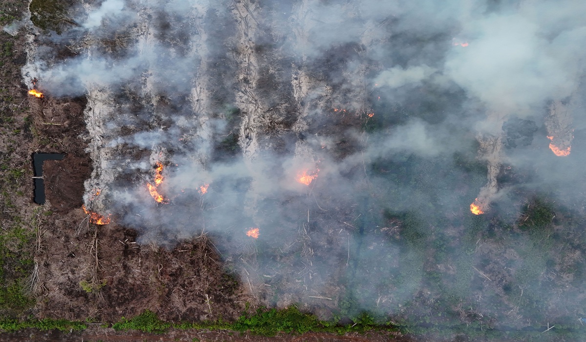
The number of forest and land fire hotspots in Indonesia has soared by more than 205% compared to the same period last year. Coordinating Minister for Political and Security Affairs Djamari Chaniago stated that based on satellite monitoring from NASA’s Terra and Aqua satellites up to 15 June 2026, a total of 1,007 hotspots had been detected. This marks a sharp increase from the 330 hotspots recorded during the same timeframe in 2025. ‘This condition is of great concern because hotspots are an early indicator of the rising potential for forest and land fires if not addressed quickly and precisely,’ Djamari said during a coordination meeting in Central Jakarta on Thursday (18/6).
In addition to the hotspot surge, the total area affected by forest and land fires nationally had reached 81,077 hectares by the end of May 2026. Throughout 2025, the total burned area was recorded at 359,619 hectares, only slightly lower than the 376,805 hectares recorded in 2024. Djamari noted that these figures demonstrate that forest and land fires remain a serious threat requiring vigilance and preparedness from all stakeholders.
The government is also closely monitoring climatic developments pointing towards El Niño. According to the latest analysis from the Meteorology, Climatology, and Geophysics Agency (BMKG), the ENSO condition at the beginning of 2026 was in a neutral phase trending towards El Niño, with indications of development between May and July 2026. ‘The El Niño phenomenon correlates with an increased risk of drought, reduced rainfall, a higher number of hotspots, and greater potential for forest and land fires,’ Djamari explained.
In response, the government has reactivated the 2026 Forest and Land Fire Control Coordination Desk to ensure that all policies, resources, and handling measures are integrated from the central to regional levels. Djamari highlighted six priority provinces with high vulnerability: Riau, Jambi, South Sumatra, West Kalimantan, Central Kalimantan, and South Kalimantan. These areas are considered highly susceptible due to the dominance of peatlands, extensive forest and plantation areas, and weather conditions conducive to fires during the dry season. He urged local governments, along with the military, police, regional disaster management agencies, firefighting units, and the private sector, to enhance preparedness immediately. ‘Ensure all alert posts function optimally and carry out integrated patrols consistently. Strengthen early detection systems, ensure equipment and personnel are operationally ready, and actively involve businesses and the community,’ he stressed.