
Hotspots No Longer Visible at Bromo, Officers Continue Mop-Up Operations
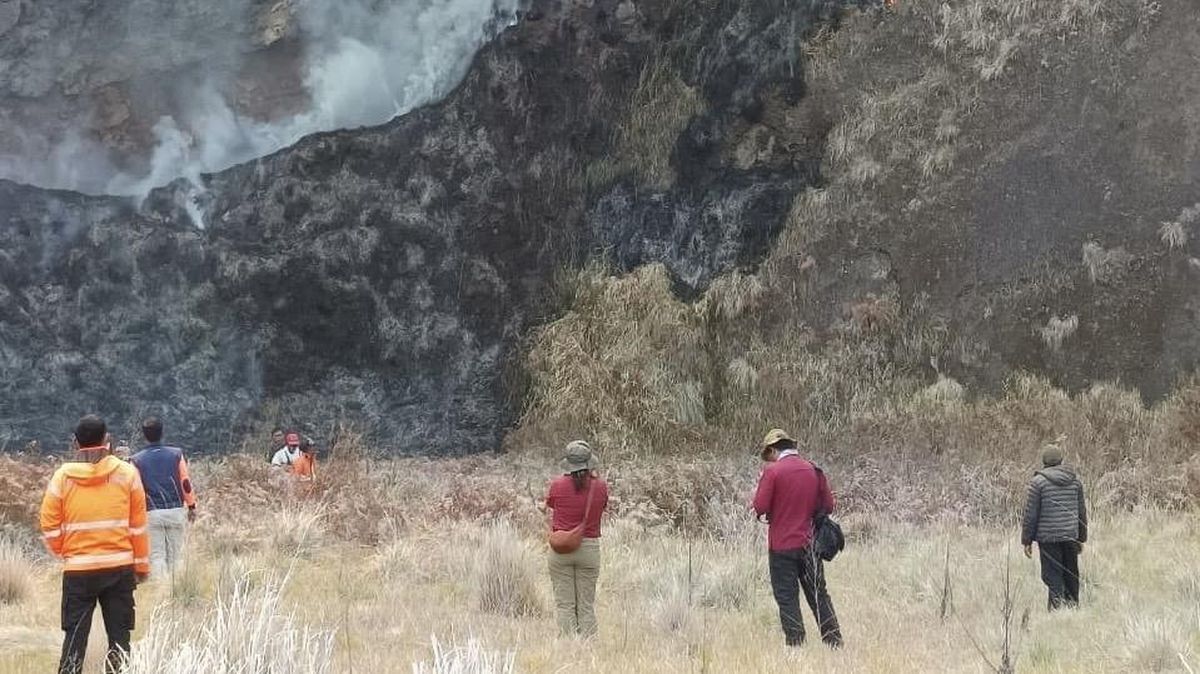
Joint personnel in the Mount Bromo area are continuing dousing and water bombing operations, even though the fire is reported to have subsided and hotspots are no longer visible at the site.
Head of Emergency and Logistics at the East Java Provincial Disaster Mitigation Agency (BPBD), Satriyo Nurseno, said on Friday (14/8) afternoon that fire hotspots were no longer visible in the Bromo area.
“For now, hotspots are nil,” Satriyo told CNNIndonesia.com.
Nevertheless, ground dousing efforts are being continued by the joint team to ensure no embers remain in the Bukit Cinta area.
“The joint team is continuing ground sweeps at Bukit Cinta to extinguish and douse using manual gepyok methods, backpack power sprayers (blower sprayers), fire engine units, Komodo tactical vehicles, and water tanker trucks across all accessible areas,” he said.
From the air, Satriyo said three helicopters have also been deployed for water bombing operations at target points in the Pakis Bincil area, which is still emitting smoke.
“Three helicopters — PK-DAN and PK-DBM belonging to BNPB, and PK-DAP belonging to the East Java Provincial Government — are carrying out water bombing operations at target points in the Pakis Bincil area where smoke plumes are present,” he said.
During the water bombing operation, helicopter PK-DAP, with a capacity of 1,000 litres, flew two sorties from Ranu Pani with a total of five trips amounting to 4,000 litres. Helicopter PK-DBM, with the same capacity, flew two sorties with seven trips amounting to 7,000 litres.
Meanwhile, helicopter PK-DAN, with a capacity of 4,000 litres, flew one sortie from Ranu Regulo with ten trips amounting to 40,000 litres.
“The total water bombing operation has reached 22 trips and 51,000 litres,” he said.
East Java BPBD personnel have also deployed drones to monitor smoke points or fires that could still potentially emerge, while ensuring no embers remain that could reignite the fire.
“The joint team is conducting further sweeps to ensure no remaining embers could trigger reignition, while also dousing locations still indicated to be emitting smoke,” he said.
The burned area in this incident is estimated to have reached 1,120.3 hectares. A number of vegetation areas were burned. Nevertheless, Satriyo said no casualties were found as a result of the incident.
“The burned area is approximately 1,120.3 hectares. The data is still developing as re-mapping is underway,” he said.
As is known, the fire in the Bromo area began on Monday (3/8) at around 17.00 WIB. Following the spread of hotspots, the Bromo Tengger Semeru National Park (TNBTS) temporarily closed all tourist access to the Mount Bromo area from Saturday (8/8) evening.