
Google's New AI Image Feature in Earth Suspended After Just One Day
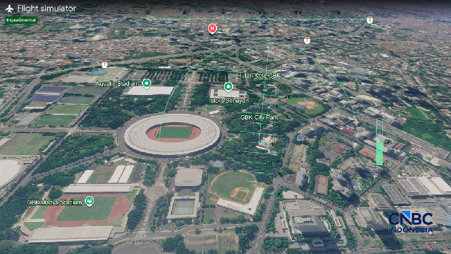
Jakarta, CNBC Indonesia — Alphabet’s Google has withdrawn the AI-powered image creation feature it introduced in Google Earth just a day earlier, after users shared images that appeared to violate the company’s policies.
The feature, powered by Google’s Nano Banana 2 AI model, previously allowed users to create photorealistic images based on satellite, aerial and 3D imagery from Google Earth simply by entering a text prompt for any location in the world.
The tool drew criticism over its potential to spread disinformation, as it allowed users to fabricate scenarios on top of real imagery of famous monuments and landmarks.
“We have seen geospatial professionals using this feature for a variety of useful purposes, but we have also seen people sharing screenshots of AI-generated images that appear to violate our policies,” Google said on X, as quoted by Reuters on Monday (3/8/2026).
The company added that it had suspended the feature’s capabilities temporarily whilst it works on stronger guardrails.
Google did not detail which types of images breached its policies. The company stated that the images did not appear in the main Google Earth view and had been watermarked as AI-generated.
As technology giants race to integrate AI tools across their products, they are also having to adjust, restrict or temporarily disable such features in response to user abuse, disinformation and policy issues.
Earlier this month, Meta also halted Muse Image, an AI feature that allowed users to generate images using public Instagram accounts, after widespread criticism over privacy concerns, including from Hollywood trade unions.
The AI feature in Google Earth
For context, the newly suspended Google Earth feature integrates Nano Banana 2 AI technology embedded directly into the Google Earth mapping software.
The feature allowed users to create AI images based on the location currently displayed in Google Earth. Users simply pressed the Create Image button in the Google Earth toolbar and entered a text prompt to generate a new visual.
For more than 20 years, Google Earth has been known as a tool for exploring locations on Earth and even beyond the planet. Unlike Google Maps, which focuses on navigation, Google Earth is designed for location exploration and area visualisation.
One of the most obvious uses is architectural visualisation.
Citing an experiment carried out by ZDNet, the AI can be asked to alter the appearance of a house, for instance by adding a front porch or changing the building’s design.
However, the results are not always accurate, as the AI can misidentify objects or modify buildings that were not intended.
As such, its use for professional work remains limited. For needs such as architectural rendering, processing via Gemini with Street View imagery is still considered more practical.
Nevertheless, the feature showed better results when used on satellite and terrain views. In one experiment, an area in Palm Bay, Florida, known as The Compound, was transformed by the AI into a modern community complete with shopping districts, residential neighbourhoods and houses in the historic style characteristic of central Florida.
The AI was also able to imagine the area in the Victorian era, with streets and visual elements adapted to that period.
Such capabilities are considered potentially useful for urban planners or architects wishing to visualise changes to an area before a project is undertaken.
Another experiment was carried out on Independence Hall in Philadelphia. The AI was asked to show how the area looked in July 1776, then in 1876 and 1976.
The results showed that Nano Banana had not yet drawn on deeper historical data. Several important buildings did not appear as they would have historically, whilst the layout and size of buildings also differed from reality.
Similar issues emerged when the AI was asked to turn images into infographics. The AI produced attractive visuals but still struggled to generate accurate text and correctly place city elements.
Google Earth can also produce creative interpretations, for example transforming Philadelphia into a steampunk-style city with giant cogs and futuristic elements, although the logic of object placement still felt odd.
Overall, Nano Banana in Google Earth is regarded more as an add-on feature than a true AI integration that genuinely understands Google Earth’s location data.
The AI works as if it merely receives a screenshot and a prompt, rather than accessing deep knowledge of the environment being displayed.
Although these experiments were rather intriguing, the feature is clearly not yet reliable as a tool that is truly ready for professional use. Moreover, the disinformation issue that has engulfed it poses a challenge for such features to be operated at scale.
Source: jawawa.id (https://jawawa.id/newsitem/googles-new-ai-image-feature-in-earth-suspended-after-just-one-day-1785757939)
Originally published by CNBC Indonesia (https://www.cnbcindonesia.com/tech/20260803141046-37-756091/fitur-baru-google-jadi-sorotan-baru-sehari-langsung-diblokir), translated from Indonesian