
Goa Beloyot: Kalimantan's Ancient Footprints Towards Geopark Status
In the eastern interior of Kalimantan lies a karst area of more than 1.8 million hectares, the largest in Kalimantan. This is the Sangkulirang-Mangkalihat landscape, stretching from East Kutai Regency to Berau. Behind the giant rock cliffs, cave passages, and dense tropical forests, there is more than just natural beauty. There are traces of life history tens of thousands of years old, unique geological wealth, and new hope for community welfare. The area is now taking firm steps towards the status of a National Geopark, and is even continuing to fulfil a number of requirements to achieve world recognition from UNESCO.
The Provincial Government of East Kalimantan (Kaltim) realises that managing such a vast area cannot be done alone. Therefore, the broadest possible synergy is being built. Academics from Mulawarman University (Unmul) Samarinda, business actors, conservation communities such as the Nusantara Nature Conservation Foundation (YKAN), and the Nusantara Capital City (IKN) Study Centre are being embraced to collaborate. This cross-institutional cooperation is key to ensuring that the natural and ancestral cultural heritage remains preserved, while providing tangible benefits for local residents. “The support of local government, communities, scientists, and entrepreneurs is the main foundation in realising the Sangkulirang-Mangkalihat Geopark,” said Siti Fahri Syahliana, Expert Staff for Bureaucratic Reform and Finance of the East Kalimantan Provincial Government. Moreover, a geopark is not just an ordinary tourist area. It is a sustainable development concept that combines three main pillars: nature conservation, educational facilities, and a driver of the people’s economy.
To understand how valuable this area is, one can explore one of the most special sites in Goa Beloyot. The journey to this place is no ordinary trip. From Merabu Village, visitors must walk along a footpath for about two hours. The path is still a natural route that is often muddy, crossing small streams and penetrating the dense tropical rainforest. Rahman (48), a local guide who knows every inch of the area’s intricacies, advises visitors to wear sturdy boots and not forget to bring a raincoat. This equipment is necessary because the path is slippery and rain can fall at any time. Another piece of advice: do not wear jeans, as walking will be heavy and the inner thighs can chafe.
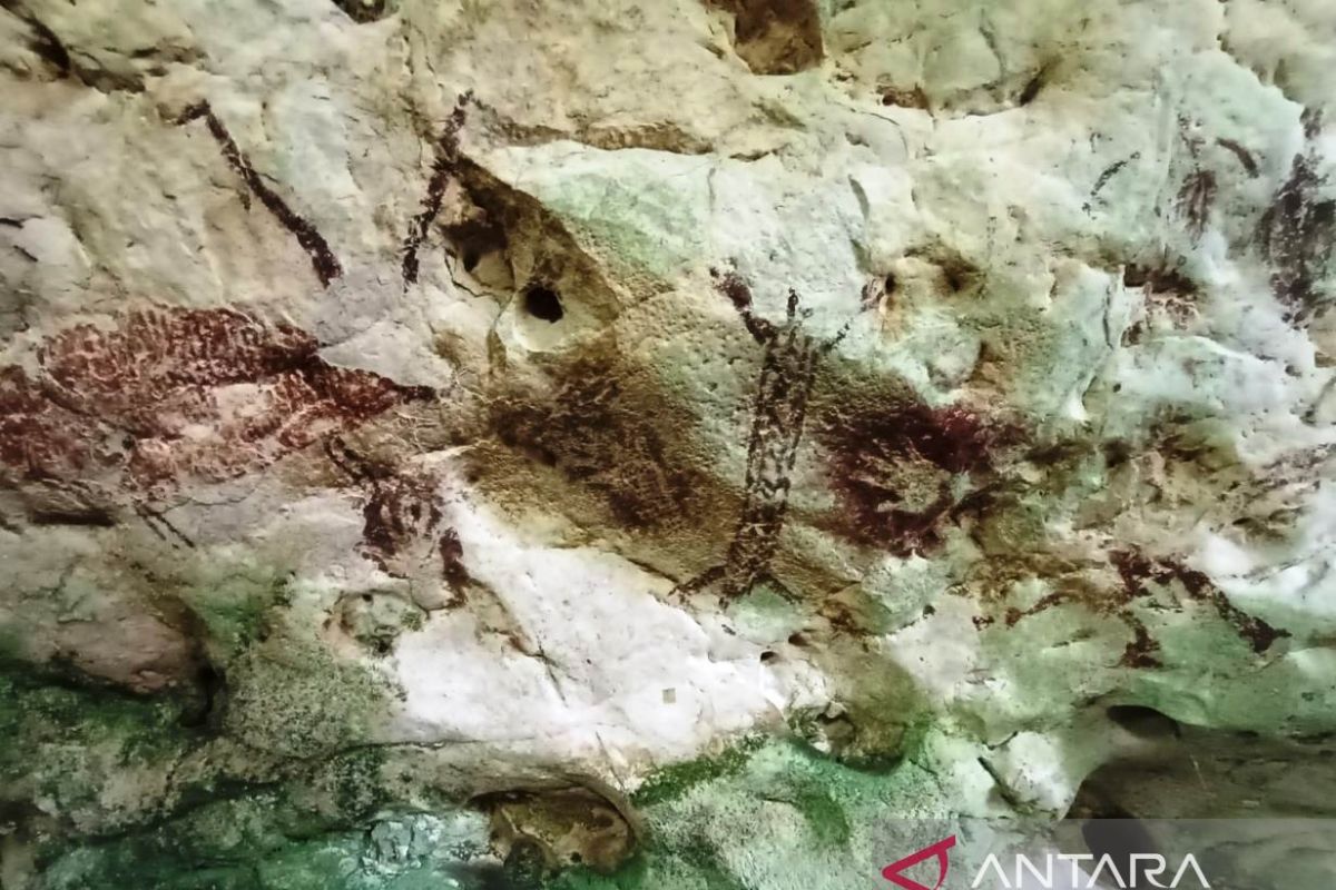
Upon arrival at the cave mouth, the journey is not over. Inside, narrow spaces force one to bow their head. There are sections where the height is only about one metre. A helmet is mandatory protection to avoid hitting the cave walls or ceiling. After traversing the dark and narrow passage that was once a swiftlet nest, the group finally arrives at the main chamber, which is as large as one and a half football pitches. Here, time seems to stand still. On the walls and ceiling of the cave, dozens of prehistoric paintings are clearly visible. There are images of red handprints, thought to originate from natural plant dyes or clay mixed with sap. There are also depictions of human figures hunting with spears, accompanied by paintings of wild boars, turtles, crabs, and other animals that were food sources for ancestors. Research findings state that the paintings and traces of civilisation in Goa Beloyot are around 40,000 years old. This means the site is one of the silent witnesses to ancient human life in Southeast Asia. Its existence proves that the region has been inhabited and managed by humans since ancient times, giving it not only geological but also cultural and historical value that allows for further research.