Giant Volcano in West Java 'Dormant' for Thousands of Years, Beware of Earthquakes and Eruptions
A team of researchers from the Geological Disaster Research Centre (PRKG) of the National Research and Innovation Agency (BRIN) has successfully uncovered physical evidence of tectonic and volcanic activity from the Quaternary era in the eastern Kuningan ring area. Junior Expert Researcher at PRKG and head of the research team, Sonny Aribowo, stated that these findings are based on geochronological analysis and high-precision LiDAR mapping of Mount Ciremai’s distal deposits.
“The background of this research is the limited data on age dating for volcanic deposits on Java Island. Yet, volcanic deposits cover nearly the entire Java region. Volcanic deposits disrupted by faults can tell stories of past history and earthquake recurrences,” said Sonny on Saturday (9/5/2026).
Sonny explained that the research aims to determine the age of Mount Ciremai’s volcanic deposits disrupted by tectonic activity. Tectonic deformation at the foot of Mount Ciremai is not merely past activity but a process systematically recorded in the soil layers.
“Through carbon dating methods on deposits along the eastern Kuningan ring road, unique geological facts were found. These facts show that deposits aged 22,000 years (22 ka) lie above deposits aged 20,000 years (20 ka),” he said.
Sonny continued that this position provides strong evidence of thrusting activity that occurred after the 20,000-year period, where older layers were pushed over younger ones.
“In addition to thrusting, evidence of normal faulting was also found in deposits around 16,000 years old, indicating a phase of sediment balancing after major tectonic pressure or possibly traces of a large earthquake event during that period,” he explained.
According to Sonny, the research also differentiates the characteristics of materials between distal (far) and proximal (near) deposits of Mount Ciremai. Based on trace element analysis and TAS diagrams, distal deposits are classified as sub-alkaline basaltic volcanic sediments with high iron content and low silica. Meanwhile, proximal deposits, based on previous studies in Wildan Hamzah’s dissertation, show that the area near the summit is dominated by basaltic andesite rocks with a medium-K magma series.
This geochemical composition helps researchers trace the origin of the material and the direction of ancient eruptions from Mount Ciremai. However, the relationship between distal and proximal deposits still requires further study due to differences in characteristics. On the other hand, Sonny said that distal deposits around 15,000 years old indicate that an eruption occurred during that period.
The use of Light Detection and Ranging (LiDAR) data in the eastern Kuningan ring area allowed the team to observe Earth’s surface features without vegetation obstruction. Sonny said the results show clear tilting of layers and faulting in the land morphology.
“Radiocarbon and LiDAR data provide important updates to the chronology of Mount Ciremai’s eruptions. These findings indicate that tectonic deformation phases in the Kuningan area occurred alongside the mountain’s volcanism history,” said Sonny.
The area around Mount Ciremai, particularly in Kuningan, has high geological complexity. Sonny explained that integrating data on explosive eruptions (from 40,800 years ago to historical periods) and active fault data is crucial. Such data can be used to develop safer settlement spatial planning, estimate earthquake recurrence periods along active fault lines, and enhance multi-hazard early warning systems, both volcanic and tectonic.
“It is hoped that with more age data on rocks disrupted by tectonic activity, recurrence periods and seismic history can be better understood. Thus, the potential hazards of earthquakes and volcanism can be better evaluated to support future development,” said Sonny.
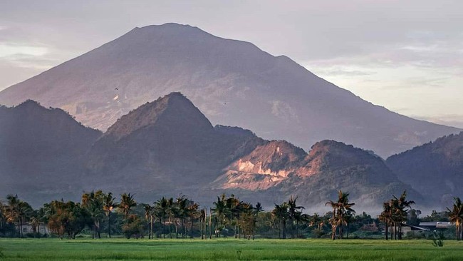
Mount Ciremai is a volcano located in West Java, Indonesia. The mountain has an elevation of 3,078 metres above sea level and is the highest peak in West Java Province. Mount Ciremai is situated in Kuningan Regency and Majalengka Regency. It is one of Indonesia’s still-active volcanoes, though currently no significant volcanic activity has been recorded.