
Geological Agency: Secondary hazards from NTT earthquake include liquefaction
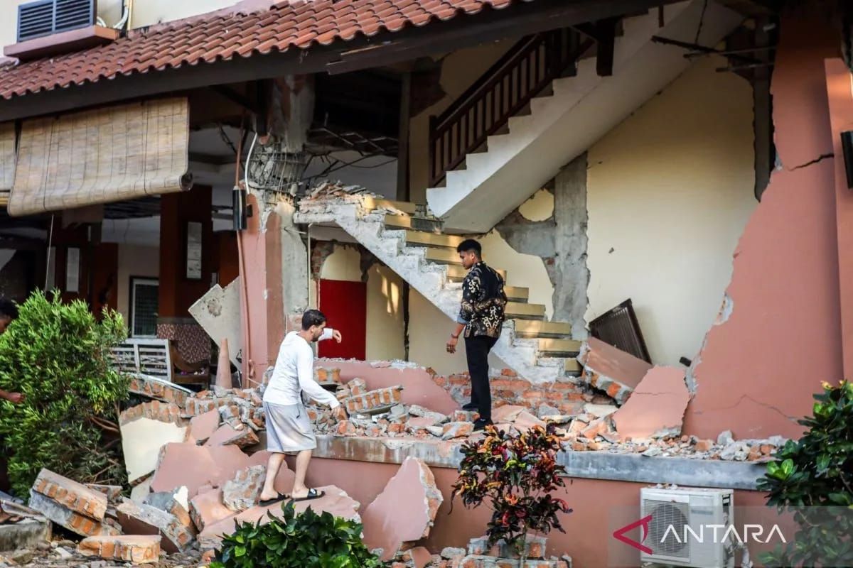
The Geological Agency of the Ministry of Energy and Mineral Resources has identified that the magnitude 7.7 earthquake at a depth of 15 kilometres in East Nusa Tenggara has produced secondary hazards that require vigilance, ranging from ground movement to liquefaction.
Head of the Geological Agency Lana Saria in Bandung on Saturday said these indications were based on documentary photographs from the field showing the impact of shaking, including wall cracks, damage to building components, partial structural collapse, and reports of water emerging from the ground.
“In addition to the direct impact of shaking, we have also identified several secondary hazards, including tsunami, ground movement, ground cracks, and indications of liquefaction,” Lana said.
In Waekokak–Mbay, water was reported to have emerged from the ground after the earthquake, while in Bonea, Selayar, a small tsunami was observed.
The impact is estimated to be more significant in areas closer to the source, particularly in alluvial plain areas such as parts of Nagekeo.
“I need to emphasise that this analysis is a rapid analysis and serves as the basis for determining locations that need to be prioritised for field verification,” she said.
Lana specifically highlighted reports of water emerging from the ground shortly after the earthquake in Waekokak–Mbay. Initially, she said, this phenomenon is estimated to be related to liquefaction in the form of sand boils or sandy and muddy water eruptions.
“However, the final conclusion still requires direct identification and examination in the field,” she said.
As a follow-up, Lana said the Geological Agency will dispatch an Earthquake Disaster Emergency Response Investigation Team to the affected locations.
The team will conduct a rapid assessment to verify field conditions, deepen the analysis, and formulate technical mitigation recommendations.
“The results of this investigation will subsequently be conveyed to local governments and policy makers as a basis for emergency handling and further mitigation measures,” she said.
For the public and stakeholders, the Geological Agency has urged people to remain calm, follow the instructions of the regional disaster management agency and local government, and be alert to aftershocks. The public should also not trust information that cannot be verified.
Additionally, people need to inspect the condition of buildings before reusing them, comply with signs and evacuation routes, and avoid cliff areas that are prone to landslides, especially during rain.
“Going forward, the application of earthquake-resistant building standards must become an important part of mitigation efforts in vulnerable areas,” she said.