
Forest Fires in Mount Butak and Mount Kawi Spread to Blitar Regency
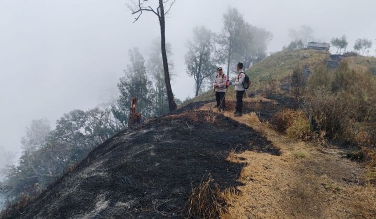
Forest and land fires (karhutla) in the Mount Butak and Mount Kawi areas have now spread to the Blitar Regency region, East Java.
“The fire has begun to creep towards the southern slope of Mount Butak. This enters the administrative area of Blitar Regency, specifically Krisik Village,” said the Administrator of Perum Perhutani KPH Malang, Kelik Djatmiko, on Thursday (17/9).
A joint firefighting team has been deployed but is facing obstacles due to the steep terrain. Perum Perhutani KPH Malang confirmed that the fire points have spread far towards the southern slope. The affected area within the Blitar administrative region is confirmed to be within the Krisik Village area, Gandusari District.
The fire entered the Blitar area since Tuesday (15/9). The flames spread due to high wind speeds and the rapid burning of dry vegetation along the slope paths.
“We estimate the fire entered Blitar since yesterday, as the wind was blowing quite strongly,” said Kelik.
The total area of land burnt in the Malang and Blitar Regency areas is estimated to reach 1,050 hectares.
To extinguish the fires on Mount Butak and Mount Kawi, water bombing helicopters have been deployed over the last three days.
“The fire has not yet been extinguished,” said Kelik.
Helicopters had performed 11 water drops until 11:00 WIB yesterday (16/9). However, all aerial operations had to be completely halted due to weather conditions deemed very dangerous for flight.
Another challenge, he revealed, is the extreme terrain caused by the steep topography of the slopes. This makes it difficult for officers to reach the area using vehicles. The current focus, he explained, is for the firefighting team to manually create fire breaks to contain the spread of the flames.
Containment and monitoring of the fire’s movement are being conducted from several alert posts around the slopes of Mount Buthak-Kawi. Hundreds of joint personnel have been deployed in waves from five to six monitoring posts.
“There are posts in Ngantang, South Pujon, the Buthak-Panderman climbing route, Selorejo, and Wagir or Krecek; each post is sending personnel to assist in firefighting,” he added.
Forest fires also recently hit peatlands and shrubs in Wonotirto. Joint teams are conducting firefighting and cooling operations to prevent the fire from re-emerging.
Meanwhile, Mount Semeru, located between Lumajang and Malang, East Java, erupted again on Wednesday (17/9) night accompanied by a loud boom. Mount Semeru experienced three eruptions on Monday (14/9/2026) morning, with ash columns reaching heights of up to 1,000 metres. The status of Mount Semeru remains at Level III (Alert).
A total of 14 mountains in East Java have experienced forest fires during the 2026 dry season. BPBD East Java is focusing on handling the five remaining fire points, including Mount Bromo and Mount Argopuro.