
Forest Fires in Jambi Reach 33,000 Hectares!
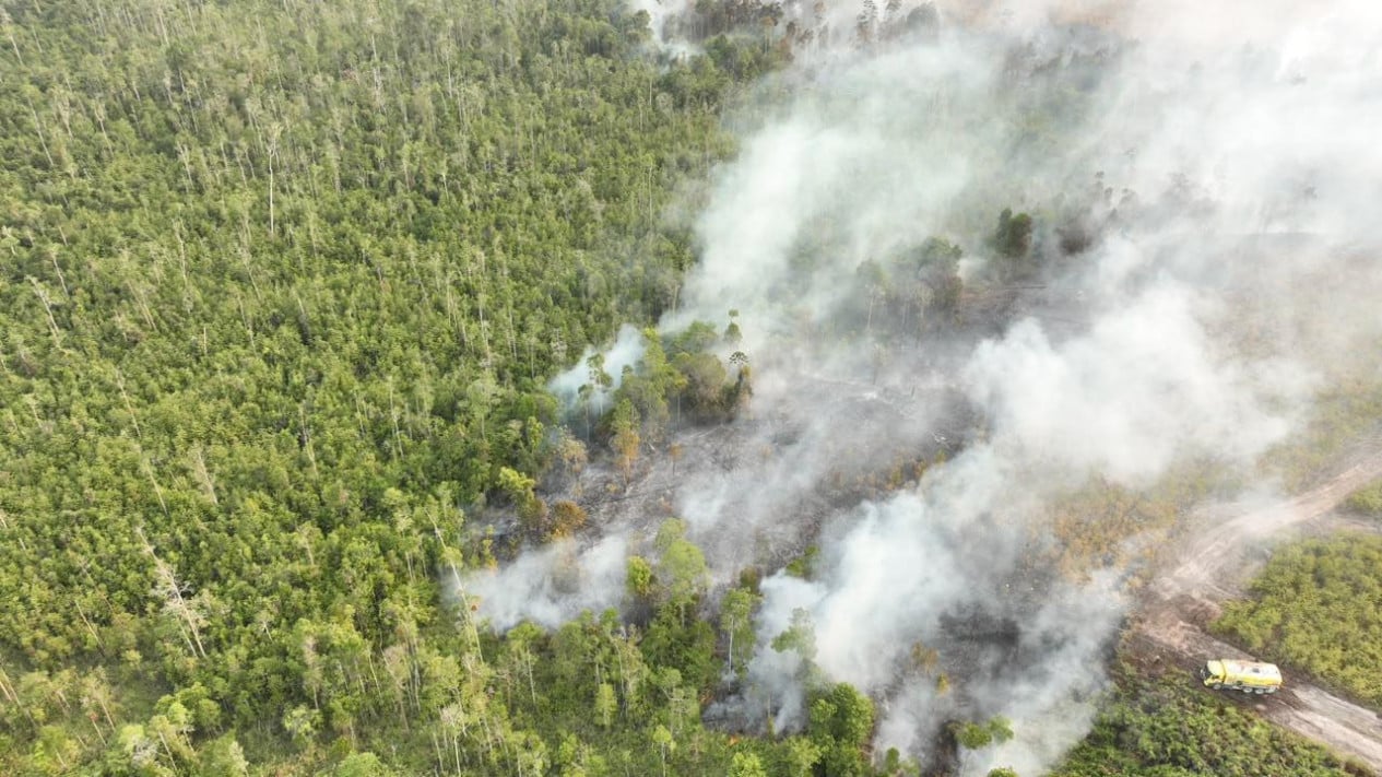
According to the latest mapping analysis from the Geographic Information System (GIS) unit of the Indonesian Conservation Community (KKI) Warsi, the area burned in Jambi has reached approximately 33,000 hectares.
The most concerning fires, which have drawn significant attention, are occurring within the Berbak and Sembilang National Park (TNBS) because they are affecting peatland ecosystems.
“Peat fires are much more difficult to control and require different handling,” said Rudi Syaf, Communications Manager of KKI Warsi, in a statement from Jambi on Friday, 25 September 2026.
He explained that the fires in this conservation area began in the Sembilang area, located in the South Sumatra Province—specifically within the traditional zone—and have continued to spread into the jungle zone, now entering the core area located within the Jambi Province.
This situation demonstrates how fires in peat landscapes can expand beyond administrative or management boundaries. When peat is dry, fire can move beneath the surface and resurface at locations quite far from the initial ignition point.
He further noted that analysis shows fire conditions jumping across riverbeds. This phenomenon is an indicator that requires attention, as rivers and water bodies are vital components in maintaining the moisture of the peat landscape.
When the landscape is extremely dry, the peat’s ability to retain water also decreases. Dry weather conditions influenced by the El Niño phenomenon have further increased this vulnerability.
However, climate factors are not the only issue; human activities around the area also require attention, particularly activities carried out without understanding the character and vulnerability levels of the peat ecosystem.
“In the current situation, the approach is not enough to just extinguish the fire. We also need to strengthen community understanding regarding the character of peat, how to manage land without fire, how to protect water sources, and how to recognise early signs of fire,” he added.
In addition to TNBS, Rudi revealed that fires have also been detected in the southern part of the Bukit Tigapuluh National Park, particularly in production forest and protected forest areas.
From the spatial analysis conducted by KKI Warsi, almost half of the identified burned areas are located within production forest and limited production forest zones.
Source: jawawa.id (https://jawawa.id/newsitem/forest-fires-in-jambi-reach-33-000-hectares-1790351510)
Originally published by VIVA.co.id (https://www.viva.co.id/berita/nasional/1931154-karhutla-di-jambi-capai-33-ribu-hektare), translated from Indonesian