
Forest Fire Hotspots in Kalimantan Quadruple in a Single Day
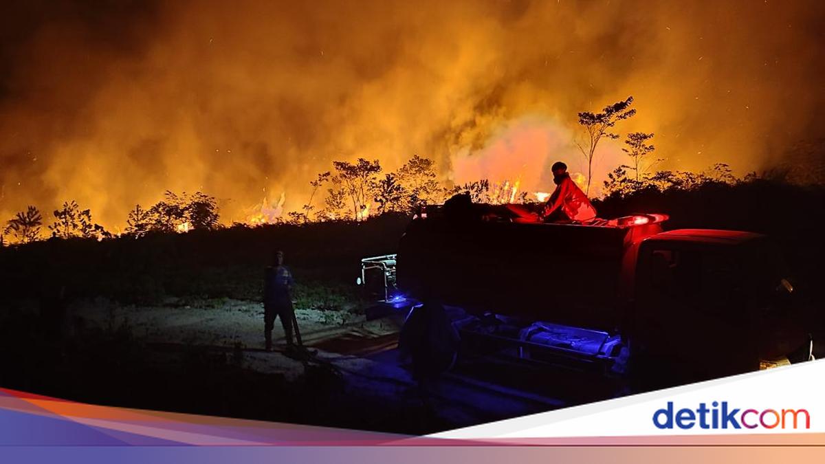
The Ministry of Forestry (Kemenhut) has recorded an increase in hotspots caused by forest fires in Kalimantan. Hotspots quadrupled in a single day.
“Based on the update of the Forest and Land Fire Monitoring System (SIPONGI) of the Ministry of Forestry, monitoring by the NASA-MODIS/Terra-Aqua satellite with high confidence level shows dynamic hotspot developments during 17–19 August 2026,” the ministry stated on its official website on Friday (21/8/2026).
On 17 August 2026 at 07.00 WIB, according to ministry data, there were 93 high-confidence hotspots in West Kalimantan, 28 in Central Kalimantan, and two in South Kalimantan. The total across the three provinces reached 123 points.
On 18 August 2026 at 07.00 WIB, hotspots in West Kalimantan fell to 15 points. Meanwhile, Central Kalimantan rose to 73 points and South Kalimantan to 21 points. The total number of high-confidence hotspots that day reached 109 points.
A significant increase in hotspots was detected on 19 August 2026 at 07.00 WIB. The ministry recorded 259 high-confidence hotspots in West Kalimantan, 242 in Central Kalimantan, and 17 in South Kalimantan.
“The total across the three provinces reached 518 points, or more than four times the previous day,” the ministry stated.
Cumulatively during 17–19 August 2026, 367 high-confidence hotspots were detected in West Kalimantan, 343 in Central Kalimantan, and 40 in South Kalimantan. The ministry said the total number of high-confidence hotspots in the three provinces during that period reached 750 points.
“Hotspots in the high-confidence category indicate a higher level of detection certainty regarding heat anomalies. However, hotspots do not automatically indicate the number of fire incidents. A single fire incident can be detected as several hotspots. Therefore, every piece of information is still verified through field checks to confirm the condition, location, cause, and area burned,” the ministry wrote.
The ministry said the increase in hotspots also does not necessarily reflect the density of smoke in a given location. It said the spread of smoke is influenced by the location of fires, wind direction and speed, humidity, atmospheric conditions, land characteristics, and the accumulation of smoke from several areas.
“Hotspot data needs to be analysed together with meteorological data, air quality, smoke distribution imagery, and field reports,” the ministry wrote.
The ministry said it has received and followed up on public reports regarding smoke haze and limited visibility. The reports included various videos and information from Sungai Tabuk, Banjarbaru, Banjarmasin, Palangka Raya, Pontianak, and several other areas.
“The visuals submitted by the public depict real conditions at specific locations and time periods and serve as important input for the government in directing patrols, field inspections, fire suppression, and public protection in affected areas. The government understands public concerns and ensures that every report is handled seriously,” the ministry wrote.
The ministry said figures reported by the public are visual observations at specific points and do not necessarily reflect uniform conditions across all of Kalimantan. Official information on visibility should refer to BMKG, airport authorities, or other authorised agencies, including the location, time, and observation method.
“Data on 19 August 2026 show different visibility conditions between regions. At Supadio Airport, Pontianak, West Kalimantan, BMKG recorded smoky conditions with visibility of around 1.2 kilometres at 08.00 WIB. In Palangka Raya, Central Kalimantan, observations by BMKG’s Directorate of Aviation Meteorology at around 07.30 WIB showed visibility of around 3 kilometres. Meanwhile, at Syamsudin Noor International Airport, South Kalimantan, airport operational data recorded visibility dropping to around 400 metres at 07.00 WITA,” the ministry wrote.
The ministry noted that information on 20 August 2026 showed visibility conditions in several areas had improved. It said BMKG recorded visibility at Supadio Airport of around 4 kilometres in smoky conditions at 10.00 WIB. At the same time, visibility at Tjilik Riwut Airport, Palangka Raya, was recorded at around 6 kilometres. In several locations in Banjarbaru, visibility had returned to more than 10 kilometres.
“This improvement does not negate the severe conditions previously experienced by the public or the need to remain vigilant. These data show that smoke haze is dynamic and can change according to time, fire location, wind direction and speed, humidity, atmospheric conditions, and smoke distribution patterns,” the ministry said.
The ministry said the government continues to handle the situation in the three provinces experiencing severe forest and land fires in Kalimantan by involving around 12,880 joint personnel, consisting of 1,410 personnel in West Kalimantan, 10,700 in Central Kalimantan, and 770 in South Kalimantan. Meanwhile, the implementation of Weather Modification Operations in the Kalimantan region continues to be adjusted to atmospheric conditions, the availability of potential clouds, and the development of forest and land fires on the ground.
The ministry said forest and land fire handling in Central Kalimantan is also being carried out from the air through water bombing. Minister of Forestry Raja Juli Antoni is coordinating with the Head of BNPB to increase air fleet support for water bombing operations.