
Forest Fire Haze Turns Pontianak Sky Yellowish-Brown, Says BMKG
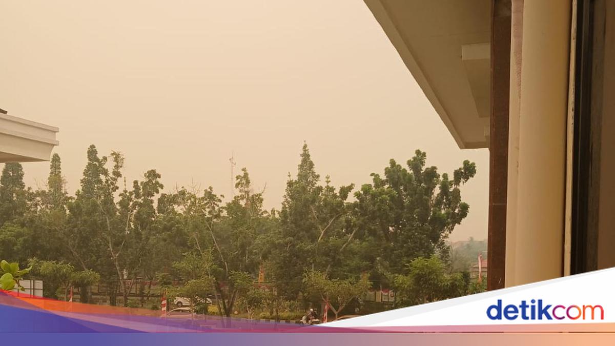
Forest and land fires (karhutla) are still occurring in West Kalimantan. The thick haze has even turned the sky over Pontianak a yellowish-brown colour.
Based on photographs received by detikcom, the sky in Pontianak city appeared yellow due to smoke from the forest and land fires. The photo was taken on Friday (28/8) at midday, but the yellowing sky made conditions look like late afternoon.
The haze has also reduced visibility in West Kalimantan’s airspace. The Meteorology, Climatology and Geophysics Agency (BMKG) has provided an explanation of the conditions.
“Based on BMKG West Kalimantan monitoring, the yellowish appearance of the Pontianak sky this afternoon is related to the presence of smoke and high concentrations of particulates in the atmosphere,” said BMKG Meteorologist and Weather Forecaster Adinda Dara Vahada on Saturday (29/8/2026).
She said observations at the Dwikora Maritime Meteorology Station in Pontianak at 10.00 WIB showed hazy conditions with visibility of around 1 kilometre. The conditions were corroborated by BMKG Himawari-9 satellite imagery at 13.00 WIB, which detected smoke distribution across West Kalimantan, with dominant movement towards the northwest and north.
“BMKG also detected transboundary haze from West Kalimantan towards Sarawak, Malaysia,” she said.
In addition to reducing visibility, Adinda continued, the large amount of smoke and particulates in the atmosphere can affect the scattering of sunlight. Forest fire smoke and air pollution particles have contributed to the yellowish appearance of the sky over Pontianak.
“As a result, light reaching the surface can appear dimmer and yellowish to orange in colour, so that midday conditions can look like late afternoon. This is also consistent with PM2.5 monitoring in several areas of West Kalimantan showing fairly high particulate concentrations,” she explained.
BMKG head Teuku Faisal Fathani shared visibility data for West Kalimantan as of Friday (28/8) afternoon. The data is as follows:
Mempawah Climatology Station at 17.00 WIB: 500 metres
Dwikora Pontianak Meteorology Station at 17.00 WIB: 1,500 metres
Nanga Pinoh Melawi Meteorology Station at 17.00 WIB: 3,000 metres
Paloh meteorology post at 17.00 WIB: 2,000 metres
Pangsuma Kapuas Hulu Meteorology Station at 17.00 WIB: 3,000 metres
Rahadi Oesman Ketapang Meteorology Station at 17.00 WIB: 6,000 metres
Supadio Meteorology Station at 17.00 WIB: 1,000 metres
Tebelian Sintang Meteorology Station at 17.00 WIB: 2,500 metres
Singkawang Meteorology Station at 17.00 WIB: 3,500 metres