
Forest and Land Fires Spread in Central Kalimantan, 622 Hectares Scorched
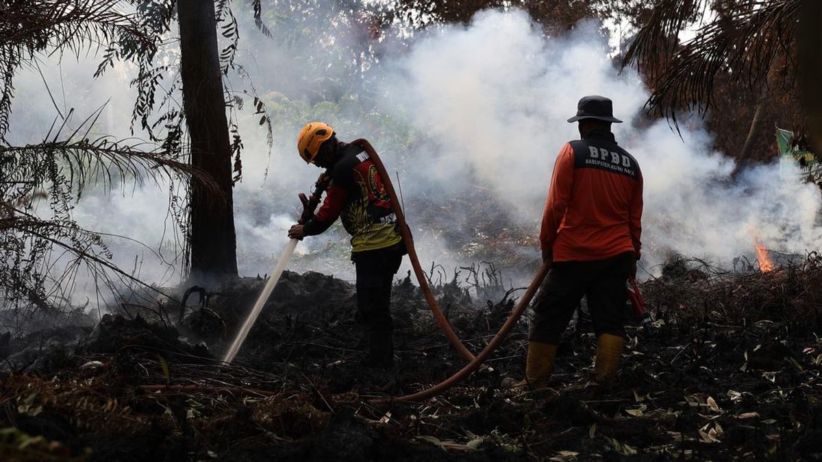
Forest and land fires in West Kotawaringin Regency, Central Kalimantan, are showing no signs of abating and are instead expanding. Entering mid-August 2026, hundreds of hotspots are still being detected and hundreds of hectares of land have been scorched. According to data from the Ministry of Forestry’s SiPongi system and the West Kotawaringin Regional Disaster Management Agency (BPBD), 168 forest and land fire incidents have been recorded from January to 13 August 2026. The total area of land burned has reached 622.1 hectares.
Head of the West Kotawaringin BPBD, Samuel, stated that the situation is a serious concern, especially as fire activity increases during the dry season. “Monitoring is continuously carried out to track the development of hotspots and fire potential in several areas,” he said on Friday (14/8). Based on SiPongi data, 379 hotspots have been monitored in West Kotawaringin throughout 2026 up to 13 August, with the majority appearing in the last two months. In August alone, 252 hotspots were recorded, while July contributed 78, with the remainder scattered across previous months.
Samuel noted that the Arut Selatan district is the area of greatest concern, recording 181 hotspots this year. Hotspots were also found in the Kumai and Arut Utara districts. In terms of incidents, Arut Selatan also ranks highest with 85 fire cases, followed by Kumai with 59 incidents. The largest burned area is in Arut Selatan, covering approximately 413.56 hectares, while Kumai has seen 110.23 hectares burned.
Samuel stressed that handling forest and land fires cannot only occur after the fire has grown large. Early detection is crucial to prevent the potential spread of fire before it expands. “The speed of information and field response is critical. Therefore, public reports are very much needed when a fire is spotted,” he said.
Acting Head of Emergency and Logistics at the West Kotawaringin BPBD, Adnan Santana, explained that increasingly dry land conditions make it easier for fires to spread. A fire that initially starts at a single point can develop rapidly if handled too late. Consequently, joint teams continue to monitor vulnerable areas, and every fire report is followed up to prevent the flames from spreading to larger areas. Adnan also reminded the public not to open or clear land by burning. In dry conditions, fire can spread quickly due to wind and flammable vegetation. “The public’s role is very important in prevention. Do not burn land, especially when the weather is dry,” he stressed.
With hundreds of hotspots and over 600 hectares of land burned, the threat of forest and land fires in West Kotawaringin remains high. The local government and joint teams are continuing to strengthen monitoring and field response. The public is urged not to wait for fires to grow, and to report any sign of fire or potentially fire-triggering activity as early as possible to speed up extinguishing efforts.
Source: jawawa.id (https://jawawa.id/newsitem/forest-and-land-fires-spread-in-central-kalimantan-622-hectares-scorched-1786697646)
Originally published by CNN Indonesia (https://www.cnnindonesia.com/nasional/20260814143442-20-1392336/karhutla-di-kalteng-meluas-622-hektare-lahan-terbakar), translated from Indonesian