
Forest and Land Fire Area on Mount Semeru Slopes Reaches 600 Hectares
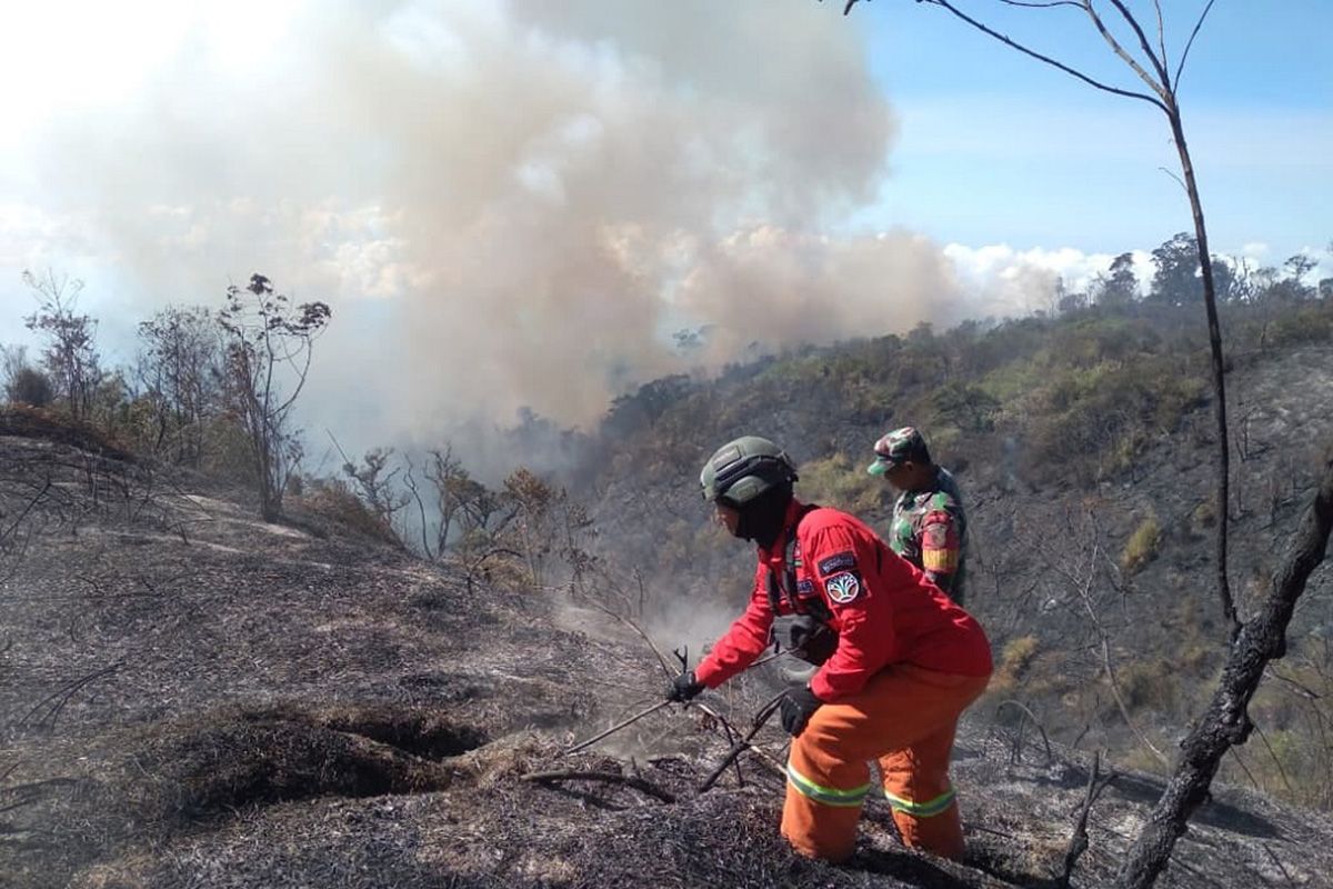
Lumajang, East Java - The area affected by forest and land fires (karhutla) on the slopes of Mount Semeru in Lumajang Regency, East Java, is estimated to have reached over 600 hectares, though this figure remains dynamic as data collection and monitoring continue.
“Joint officers are currently prioritising the control of fire movement to prevent it from entering areas adjacent to residential settlements,” said the Head of the Lumajang Regional Disaster Management Agency (BPBD), Isnugroho, when contacted via mobile phone on Monday afternoon.
According to him, the focus of the handling is directed towards controlling hotspots while simultaneously preventing the fire’s movement from approaching settlements and community land.
He stated that the fire is expanding towards Kalimati, then shifting towards Gunung Kolong, while hotspots also remain in Ayak-Ayak and the Trisula Malang junction.
The difficult terrain of the Semeru slopes poses a challenge for officers, as several hotspots cannot be accessed by firefighting vehicles, necessitating manual handling via land routes on foot.
One of the steps taken by officers is the creation of firebreaks in specific locations, which serve to slow the movement of the fire and provide a buffer to prevent the blaze from reaching residential areas and community land.
“For the community living around the affected area, this step is a vital part of the protection efforts. Control is directed not only at extinguishing hotspots but also at anticipating the direction of fire movement to minimise risks to residents,” he said.
Meanwhile, the water bombing helicopter that previously supported fire management in the Semeru area has been diverted to assist with firefighting efforts in the Kalimantan region.
“Given these conditions, control via land routes and prevention have become increasingly important. Joint officers continue to monitor hotspots and strengthen firebreaks in areas deemed to have potential for fire movement,” he added.
Isnugroho explained that the community also plays a crucial role in assisting prevention, particularly by avoiding activities that could trigger fire sources in forest and land areas. Information regarding fire developments should be obtained through officers and official sources to ensure the public is not easily influenced by unverified information.
“Efforts to control the forest and land fires on the Semeru slopes are ongoing, prioritising public safety. Monitoring, manual firefighting, and the creation of firebreaks are the steps being taken to ensure the fire does not spread towards settlements or residents’ land,” he concluded.
Source: jawawa.id (https://jawawa.id/newsitem/forest-and-land-fire-area-on-mount-semeru-slopes-reaches-600-hectares-1788188520)
Originally published by Antara (Indonesian) (https://www.antaranews.com/berita/5719392/luas-karhutla-di-kawasan-lereng-gunung-semeru-capai-600-hektare), translated from Indonesian