
Expert: Central Sulawesi Earthquake Proves Threat Extends Beyond Palu-Koro Fault
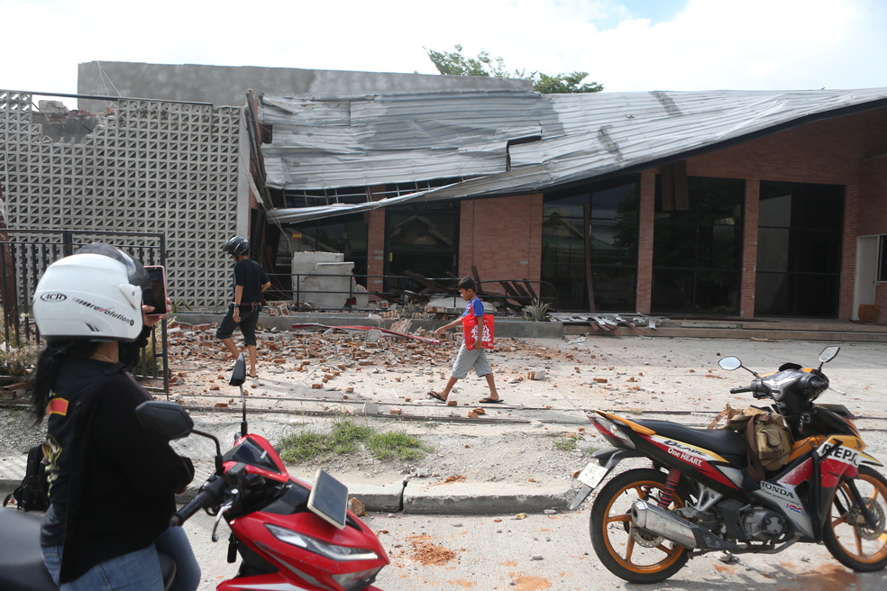
The magnitude 6.7 earthquake that shook Central Sulawesi on Tuesday (16/6) was not an ordinary seismic event. Indonesian Disaster Experts Association member Daryono assessed that the quake revealed a geological vulnerability far broader than the public has understood so far. “The seismic threat in Sulawesi does not only originate from the main Palu-Koro fault line, but also from the complex fault branches surrounding it,” Daryono said on Wednesday (17/6). He explained that the Palolo and Sausu areas are pull-apart zones formed by the dynamics of the Palu-Koro Fault. Imperfections along the main strike-slip fault line create crustal stretching that gives rise to normal faults and forms basins now filled with sedimentary deposits. This is what made the earthquake’s shaking so destructive. Daryono elaborated that soft sedimentary deposits in basin areas tend to amplify seismic waves, causing buildings above them to receive much stronger shaking compared to areas with hard bedrock. The majority of affected buildings were non-engineered structures that did not meet earthquake resistance standards. Massive damage was evident from hundreds of houses in Sigi Regency bearing the heaviest impact, to the severance of the vital Palu-Sigi-Poso road link. The collapse of this main logistics route underlines the urgency of building more resilient infrastructure and the need for alternative evacuation routes. Daryono reminded that this region actually shows a high persistence of seismic activity based on historical earthquake records from 1983, 1995, 2005, to 2017. “The collective trauma of the community after major past events means every tremor triggers panic that needs to be managed with proper education, so that residents can distinguish between destructive and non-destructive shaking,” he said. He stressed the need for a comprehensive paradigm shift in mitigation. The focus can no longer be directed solely at the already known main fault lines, but must immediately accelerate seismic micro-zonation mapping to a more detailed level. Local governments need to make this vulnerability data the primary reference in spatial planning, including restricting construction on active fault zones. “Preparedness is no longer an option, but an absolute necessity for survival in active seismic zones like Central Sulawesi,” Daryono concluded.