
Energy Ministry maps hazard points and distributes aid following NTT earthquake
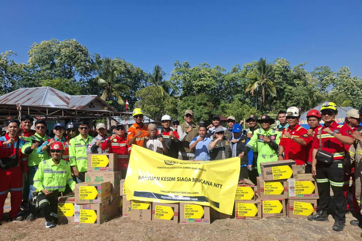
The Ministry of Energy and Mineral Resources (ESDM) is mapping disaster-prone areas in East Nusa Tenggara (NTT) to strengthen monitoring and information dissemination while also distributing aid to affected communities.
Rudy Sufahriadi, head of the ESDM Disaster Response Team, said the mapping is being carried out alongside field inspections and aid distribution in several earthquake-affected areas.
“We continue to map where disaster-prone locations are,” Rudy said in Manggarai Regency, NTT, on Monday.
During the inspection series in Manggarai, Rudy began by visiting the Anak Ranakah Volcano Observation Post, then visited and distributed aid in Watu Tango Village, and continued to the ESDM Disaster Response Post in Reok District.
The Geological Agency of the Ministry of Energy and Mineral Resources previously stated that the area around the earthquake source lies within a Medium to High Earthquake Disaster-Prone Zone.
Based on the Geological Agency’s analysis, the magnitude 7.7 earthquake on 15 August 2026 had a thrust fault mechanism associated with the Flores Back Arc Thrust Fault Zone.
The Geological Agency also noted that weathered rocks and surface sediments have the potential to amplify earthquake shaking.
The public is urged to follow local government directives, inspect building conditions, comply with evacuation routes, and avoid cliff areas that may be prone to ground movement.
Rudy said the distribution of affected areas is one of the challenges in the response because communities are located at various points with differing distances from main roads.
According to him, the team is still working to reach communities in several locations that are more difficult to access.
“There may still be people, as I have heard from some media reports, who have not yet been reached. We will try to reach them,” he said.
The Ministry of Energy and Mineral Resources has established three ESDM Disaster Response Posts to support the response in affected areas: in Lamba Leda District, East Manggarai Regency; Reok District, Manggarai Regency; and Aesesa District, Nagekeo Regency.
At the Reok ESDM Disaster Response Post, the team is also gathering community needs in surrounding villages and hamlets. Field data collection serves as the basis for determining follow-up actions according to conditions found at each location.
The three regencies where the ESDM Disaster Response Posts are located are the areas with the highest number of displaced people.
Based on the national update from the National Disaster Management Agency (BNPB) as of Sunday (23/8) at 4:00 p.m. Western Indonesia Time, the number of displaced people in Manggarai reached 46,519, Nagekeo 34,256, and East Manggarai 31,372.
Overall, BNPB recorded a total of 161,084 people displaced by the earthquake in NTT, while the death toll reached 91.
In addition to mapping hazard points, the ESDM Disaster Response Team is receiving community reports on house damage, which will then be coordinated with the National Disaster Management Agency (BNPB).
“Secondly, they report on housing infrastructure. We will convey to BNPB that the houses are cracked, and BNPB will follow up,” Rudy said.
Based on data as of Saturday (22/8), BNPB recorded a total of 53,971 damaged housing units, comprising 19,006 heavily damaged, 11,777 moderately damaged, and 23,188 lightly damaged houses.
Of that total, house damage in the three regencies where the ESDM Disaster Response Posts are located was recorded at 17,039 units in East Manggarai, 7,045 units in Manggarai, and 4,829 units in Nagekeo.
BNPB stated that the house damage data remains provisional and is still undergoing verification and validation to ensure it matches actual conditions on the ground.