Earthquake Damage Impact Far More Extensive Than Scientists Previously Thought
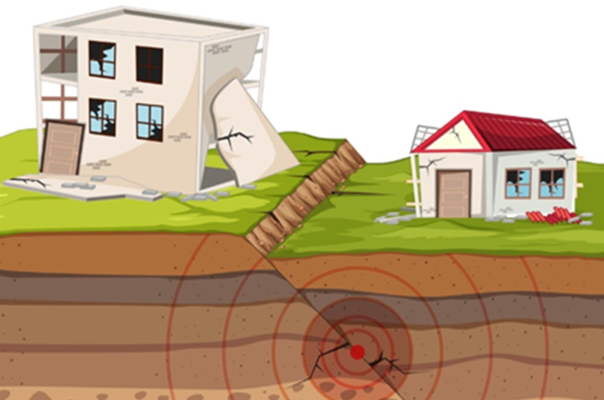
Earthquakes are among the most destructive natural disasters, capable of crippling infrastructure and threatening lives within seconds. Until now, scientists and safety authorities have used standard seismic models to predict the primary damage radius, typically concentrated around the epicentre. However, a recent geological study has revealed the surprising fact that earthquake damage can reach areas far more extensive than previously realised. The comprehensive research was conducted by re-analysing data from various major earthquake events around the world over the past few decades. Using high-level satellite imaging technology and newly developed sensitive underground sensors, the research team successfully mapped small cracks and structural ground shifts that had previously escaped conventional observation. The mapping results show that certain seismic waves have the ability to propagate and trigger structural damage to nearby buildings, even at distances previously considered safe by experts. This phenomenon occurs because the characteristics of certain local soil types can amplify secondary vibrations, creating a domino effect of damage that spreads far beyond the initially predicted main danger zone. This discovery is a stark warning for the world of civil engineering and urban planning. The risk assessment models currently used to determine earthquake-resistant building standards likely need to be re-evaluated. If the affected area is much wider, then safe zone regulations around active fault lines must also be tightened to minimise potential material losses and casualties in the future. In addition to damaging physical infrastructure such as buildings and bridges, the propagation of vibrations reaching a wider area also impacts soil stability in hilly regions. The risk of subsequent landslides has been detected to increase significantly in remote areas that were initially classified as low-risk zones after a major earthquake. Regarding the urgency of these findings, which challenge long-held understanding, one of the lead researchers in the study provided an in-depth explanation. “Our data shows that the energy released by an earthquake distributes itself in a far more complex way and reaches a wider area than current scientific models estimate,” the scientist stated in the official report. Through this latest research publication, astronomers and geology experts hope that governments in various disaster-prone countries will promptly update their early warning systems and disaster mitigation maps. Integrating this new range data is crucial so that public preparedness for potential earthquake disasters becomes far more accurate and comprehensive.