
Coastal Flooding in Surabaya: BMKG Issues Warnings Until May 21st
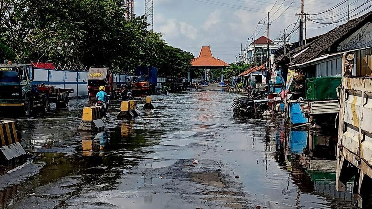
Coastal areas of Surabaya, East Java, were reportedly flooded on Saturday (May 16th) afternoon. Access roads and residential areas were inundated, causing traffic congestion.
Coordinator of the Observation and Information Division of the Meteorology, Climatology, and Geophysics Agency (BMKG) of the Maritime Meteorology Station Class II Tanjung Perak Surabaya, Sutarno, confirmed that the water level on Jalan Kalimas and Kalianak had reached 15-25 cm.
“The areas affected by the coastal flooding are Kalianak and Jalan Kalimas in Surabaya,” Sutarno said when contacted by CNNIndonesia.com.
Sutarno said that, based on BMKG Maritime’s forecast, coastal flooding will hit the coastal areas of Surabaya and other areas in East Java for six consecutive days, starting from May 16th to May 21st, 2026.
Based on atmospheric and hydrological analysis, the threat of coastal flooding is triggered by extreme monthly astronomical cycles, where the positions of the Earth, Moon, and Sun are in a condition that triggers maximum sea tides.
“The maximum sea tide that is currently occurring is a monthly cycle of the Moon’s position, where the current phase is a new moon,” he said.
The BMKG has urged people along the coast to increase their vigilance against rising sea levels, which are predicted to reach 120-160 cm.
“This condition has the potential to cause coastal flooding in coastal areas with a height of 120 to 160 centimeters from the average sea level or DPL,” he said.
In the next few days, BMKG estimates that the peak of the sea level rise will occur every day in the time window from morning to noon, specifically from 09:00 to 12:00 WIB.
The impact of this flooding is predicted to disrupt the stability of economic activities and the daily mobility of residents, especially in the maritime transportation sector, logistics activities, loading and unloading at ports, tourism, and the work of coastal fishermen.
“This phenomenon has an impact in the form of puddles of water as high as 10 to 40 centimeters on land, which can disrupt transportation around ports and coasts, the activities of salt farmers and fisheries, as well as loading and unloading activities at ports,” Sutarno said.
Furthermore, the impact of this coastal flooding, according to Sutarno, can also cause physical damage and infrastructure. This is because saltwater inundates houses, vehicles, and roads.
“Metal components on vehicles and buildings experience corrosion due to the salt content in seawater,” he said.
In addition, the puddles of dirty water from this coastal flooding can also potentially cause skin diseases, itching, coughing, and diarrhea. Clean water is also becoming scarce. The impact is also bad for the environmental ecosystem.
“Coastal flooding pollutes freshwater sources, making it difficult for residents to get clean water. Increasingly severe abrasion erodes coastal land and can damage mangrove ecosystems,” he said.
Areas other than Surabaya
According to Sutarno, the coastal areas of Surabaya and its surroundings are a serious concern because of the wide scope of the impact. BMKG has mapped a number of critical points in Surabaya that are in the red zone of vulnerability to coastal flooding.
“Coastal areas that have the potential to be affected include ports, including North Surabaya and Benowo. Then East Surabaya, including the Kenjeran and Sukolilo areas. In addition, the West Surabaya area, including buffer areas such as Gresik, Lamongan, and Tuban, must also be vigilant,” Sutarno explained.
In addition to Surabaya, this coastal flooding is also projected to spread to various other coastal areas of East Java. Based on BMKG’s forecast, the affected areas include the southern coast to the Madura region, which borders the Madura Strait.
“The potential impact also extends to Banyuwangi, Pasuruan, Sidoarjo, Probolinggo, Jember, South Bangkalan, Kuanyar, Sampang, along the Madura Strait, to the Kreseh area in western Sampang,” he said.
To overcome the impact of prolonged coastal flooding, BMKG recommends that the government take a number of measures.
“For the first step in handling, the construction of embankments, the preparation of water pumps, the repair of drainage, and the last is the preservation of mangroves,” he concluded.
In closing, Sutarno asked the public to continue to update maritime weather information through official channels and coordinate with local disaster management agencies to minimize material losses and other impacts.